.jpg) |
 |
1870-Official Guide reprint |
 |
1878 Map of Ft.Smith, larger version |
 |
Contributed by Chuck Raney |
1887 |
 |
Contributed by H. E. Huber |
Section of 1887 Map |
 |
Contributed by John Dill |
1889 |
 |
 |
1892 Sanborn Maps of downtown Ft. Smith |
 |
Contributed by John Dill |
1903 plat of downtown, larger version |
 |
Contributed by H. E. Huber |
1903 Map of Ft. Smith from SF Jct. to where AC connects to SLSF. Larger Version |
 |
 |
 |
Contributed by John Dill |
Sections of another 1903 Map |
 |
1914 map of South Ft. Smith |
 |
Contributed by John Dill |
| Fort Smith Depots: 24 - Missouri Pacific Depot; 25 - Union Station (Frisco & Kansas CIty Southern); 26 - Fort Smith & Western Depot; 27 - Midland Valley Depot. Click here for a version showing more of the city. |
 |
Contributed by Joe Wasson |
This is the Poteau River pump station. Note that it was once served by a rail spur from the Frisco. |
 |
1947 topomap of the Braden Bend area showing Ft.
Smith. |
This map shows the 1943? washout of the Braden Bend
area that took out the KCS direct line in Ft. Smith.
Larger version |
 |
1947 USGS Topo Map of Ft. Smith |
 |
Map of Sebastian County |
 |
Contributed by John Dill |
Mansfield Branch of Frisco |
 |
 |
Contributed by John Dill |
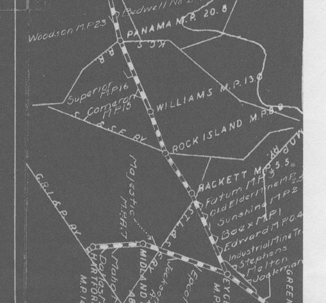
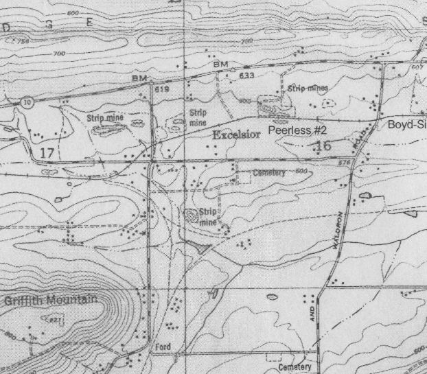
Maps of the MV in the Excelsior, AR area. |
 |
Map of Little Rock & Ft. Smith Railroad |
 |
Contributed by John Dill |
I looked this up on my "official" Frisco map. (Unfortunately it's rounded to the nearest year). Per this map, that was apparently the enity the Frisco used to build some or all of that section. In that case, Fishback may have just been acting as an agent (publicly or otherwise) for the Frisco at the time. The "Mansfield Branch" of the Frisco (Jensen to Mansfield, 1886) was built as the Little Rock & Texas Ry Co. |
This site is maintained by the Arkansas Boston Mountains Chapter of the National Railway Historical Society located in Springdale, Arkansas

Home of THE ARKANSAS SCRAMBLER
For questions, email arkyrail at outlook.com