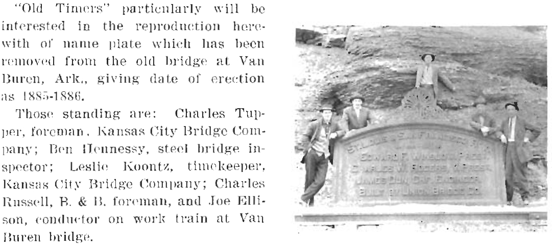
Frisco Bridges
First Bridge
 |
Collection of Mike Condren |
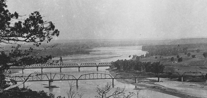
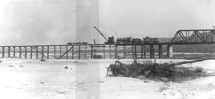
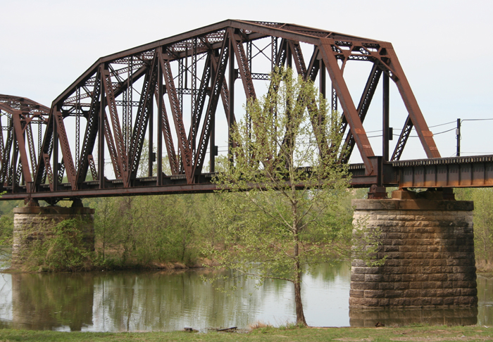
Figure 1. First Frisco bridge between Van Buren and Ft. Smith
- ca 1900, note the MoPac crossing in the foreground. This bridge was
removed after the "free bridge" was opened 1912. That second bridge went through three stages: as built, as rebuilt after 1943 flood, and for the Kerr-McClellan navigation project. |
Planning for the Bridge
| Congress authorized the Frisco railroad bridge at Van Buren on July 3, 1882 - subject to approval of the company's plans by the Chief of Engineers, United States Army.
On November 6, 1882, W. W. Belknap submitted the Frisco's plans for the proposed bridge. They were rejected on November 24th. Grounds for rejection: On December 5, 1882 the Frisco replied that: It was stated that "excessive cost of the approach on the Van Buren side, which involved a curved tunnel in very difficult soil, amounted to a prohibition of the work." On December 12, 1882 the Frisco submitted an amended bridge plan, to conform with the high water of 1844 (raised grade 3 feet). A special board considered the Frisco's proposal and rejected it. They recommended a compromise location 550 to 600 feet further upstream. A group of owners, captains, pilots and others engaged in commerce on the Arkansas also transmitted a protest against the proposed location. Frisco then, on March 8, 1883, replied that: (A) There would be little difference in either proposed site in regard to currents in the River. (B)The proposed location would endanger the transfer boat of the Little Rock and Fort Smith Railway Company, "used by them jointly with that company, which carries almost the entire traffic of Fort Smith and vicinity and would be endangered by close proximity to the bridge while under construction at the upper location."(C)The cost of the bridge would be $50,000 greater than at the proposed Van Buren location, while commerce on the Arkansas River was so insignificant that it was not worth the sacrifice. The Army Engineers replied on March 22, 1883 that: (A) The bridge approaches and piers would contract the width of the river and increase the velocity at Van Buren even more. (B) The danger to the transfer boat could be obviated by providing her with "ordinarily powerful machinery." (C) The $50,000 estimate seemed rather large. They also felt that they had already "given in" enough, especially since they had agreed to allow the construction some 2,000 feet downstream of the original site they had selected. The Frisco then suggested that a Van Buren location would allow the bridge to also function as a wagon bridge, but that could not easily be done further upstream. (This was probably done in part to win more support in Van Buren. Many people there were opposed to the bridge as it would decrease the importance of Van Buren as a shipping point.) November 6, 1883 a "memorial" from the citizens of Fort Smith suggested that "the rapidly increasing trade of that place, and that the region of country trading with it has a population of about 50,000, and ships from 20,000 to 30,000 bales of cotton besides other merchandise, which, owing to the bad condition of the navigation of the river, is dependent upon the two railroads crossing the Arkansas in a transfer boat at Van Buren, which only takes two cars at a time, and that for the want of a bridge at that point the commerce of that region is seriously embarrassed." On January 26, 1884 the Frisco formally agreed to the last set of modified terms, and to take whatever steps might be necessary to restore navigation if the bridge disrupted it, and the bridge was erected at Van Buren. |
Annual Report of the Chief of Engineers, United
States Army to the Secretary of War, 1884. (Part 2, Vol. II, pp 1792-1796) |
Construction of First Bridge
| The short history of the construction of the "original" Frisco R.R. bridge at Van Buren, Arkansas was found in Vol.XX (May, 1889) Transactions of
American Society of Civil Engineers. The article, by C.D. Purdon, deals primarily with the problems encountered and methods used to place the piers,
but information on the completion of the bridge is given.
The primary contractor for the bridge was the Union Bridge Company. William Sooysmith & Son, of Chicago, sub-contracted to do the caisson work. The bridge was of mixed iron and steel construction. A total of 1,794,247 pounds of iron and 1,153,191 pounds of steel was used in the trusses. The actual construction on the bridge began in spring 1885. It was delayed first by high water and later by late delivery of iron The last steel (for completion of the pivot span) was received on Jan. 22, 1886 and the first train, #17 Southbound, crossed the bridge at 3:30 pm on Feb 9, 1886. Two men died during the construction of the bridge. A laborer drowned and a sub-foreman died of an apparent heart attack. |
 |
|
Figure 2. The original bridge rested on 10 piers numbered from north to south, from the Van Buren bank. The pivot pier was number 4. Provision was made in the
original contract to exchange it with pier number 3 had that been found necessary. Piers 1 and 10 were built of Mountainburg, AR sandstone, but it
was judged too soft to put in piers exposed to strong current in the river. Most of the remaining building stone was limestone from quarries near
Garfield, AR and near Beaver, AR (the latter were on the Eureka Springs Railway). Most of the piers rested on rock but piers 7-9 were each built on a grillage supported by wooden piles of 26 to 30 feet in length.
The bridge superstructure consisted of 4 fixed spans of 165' length on the south end and 3 fixed spans of 256'9" length, separated by a pivot span of 366' length on the north end. The spans were all 18' clear width. Total length of the original bridge was 1,798'. The pivot span, which rotated to allow river navigation traffic when necessary, rested on a circular 30' diameter rock pier and rotated on a 27' diameter cast and wrought-iron turntable. The wheels (bearings) were to be iron, 18" diameter, 8" tread. Hand power was used to operate the elevating screws and the turning gear. Everything, including the latches, was worked from the pivot pier. The bridge was built with provision for wood planking to be placed by the railroad over the ties to permit the bridge to carry wagon traffic. This was apparently done and the bridge operated for many years as a dual purpose railroad - toll bridge. Old newspaper accounts give some additional information about this bridge. The original cost is given at about $400,000.00. The bridge apparently gave good service for many years. About the only "event" which has turned up in records was the 1892 sinking of the steamboat John Matthews after it hit the bridge. An October 4, 1913 article in the Southwest American stated that Frisco had the old trusses up for sale for about $51,000 delivered on the rivers edge or near Frisco tracks. This worked out to about 1 3/4 cents/pound, quite a bargain if you were shopping for a bridge. The newspaper article proposed using these spans (and acquiring a required additional span) to build the proposed Garrison Avenue bridge in Fort Smith. |
Contributed by John Dill |
 |
| Figure 3. This view from late 1912 or early 1913 shows the completed Free bridge and the first Frisco bridge. Note the shelter on the west side of the Frisco bridge. |
Charles Winters Collection, Contributed by John Dill |
| St Louis Iron Mountain & Southern had trackage rights over Fort Smith & Van Buren Bridge Co (a Frisco property) from STL&SF north connection [29 feet north of SLSF crossing at Van Buren] to StL&SF south connection, located between Ark River bridge and Ft. Smith. Total trackage rights mileage 1.39 mi. Agreement dated 11-24-1885 and Nov 2, 1891. Each engine or psgr car $2.00, each frt car $1.50, minimum charge of $12,000 per annum. |
Contributed by Bill Pollard |
| From Poor's Manual 1891: RR's owned or leased by SL&SF Ry.... Fort Smith & Van Buren Bridge Company. This company owns a railroad bridge over the Arkansas River, connecting the towns of Fort Smith and Van Buren. Built in 1885 and 1886 by the Union Bridge Co., and leased to the StL&SF Ry for 99 years. Rental charge is the interest on bonds. Capitol stock $500,000, all owned by SL&SF. |
Contributed by Bill Pollard |
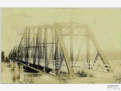
 |
Contributed by H.E.Huber |
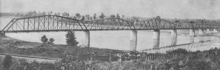
Figure 4. Post card of the original bridge looking toward Van Buren. |
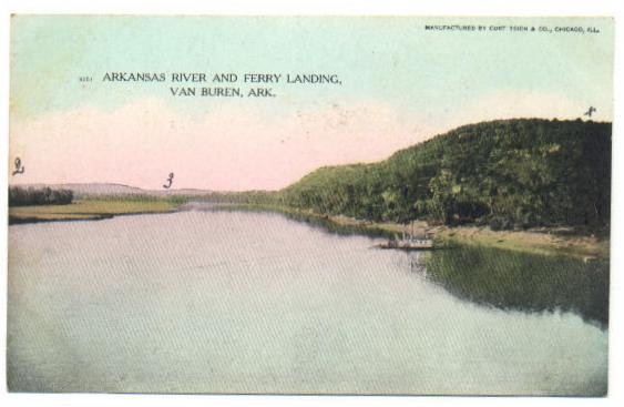 |
Contributed by H.E.Huber |
Figure 5. Before the Frisco bridge was built, there was a ferry for crossing the Arkansas River in Van Buren as depicted on this postcard. |
 |
H. E. Huber Collection |
| Figure 6. Morrilton, AR highway bridge. Some think that this was the original Frisco VB-FS bridge re-erected as a wagon bridge at Morrilton |
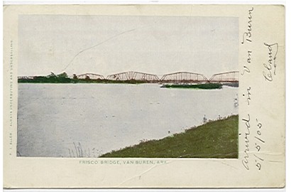 |
Collection of Mike Condren |
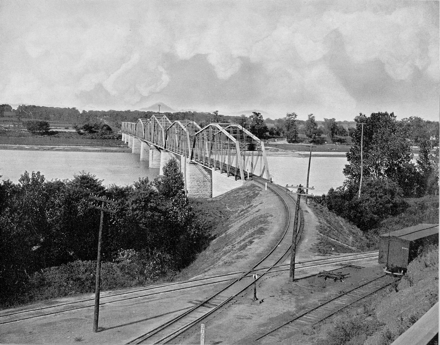
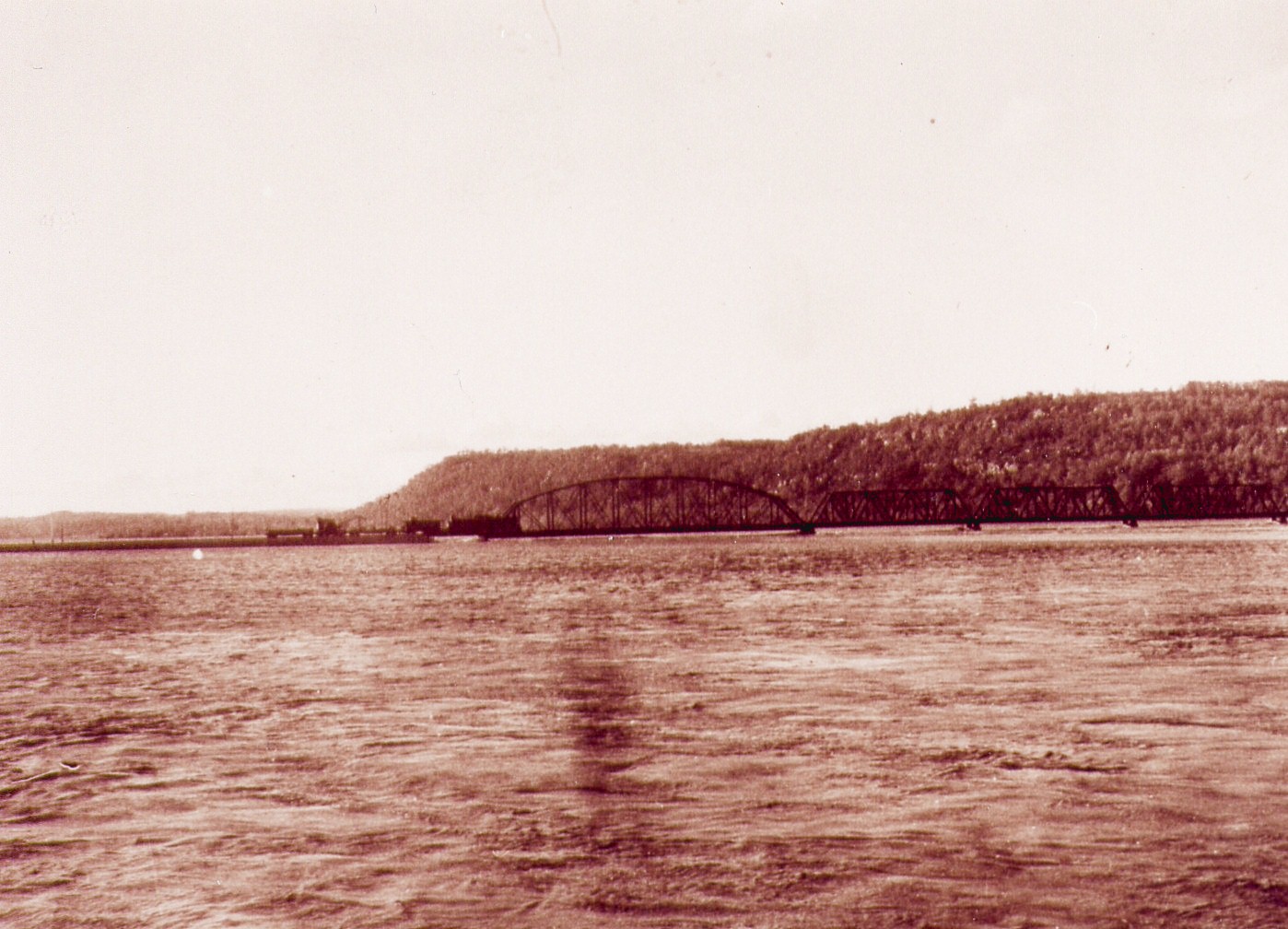
Figure 7. Frisco bridge between Van Buren and Ft. Smith -
ca 1905 |
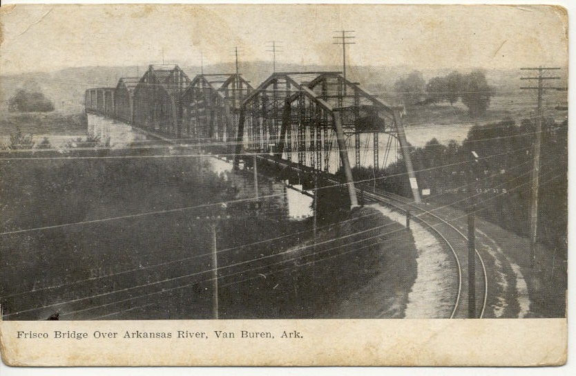 |
Contributed by H.E.Huber |
Figure 8. The original bridge looking from Van Buren toward Ft. Smith. |
 |
| Figure 9. From the Frisco Man magazine May 1914, Springfield, MO Public Library Collection |
Second Bridge
Phase I: as built
| Although it was by all accounts a fine bridge, the original Van Buren Frisco Bridge was overtaken by the growth of railroads in the 20th Century. Locomotives and other equipment rapidly increased in size and old bridges could not handle the latest equipment. In November of 1913 the Frisco undertook the ambitious project of replacing the metal superstructure of the original Van Buren bridge with new trusses which were over twice as heavy, to handle axle loads which had also doubled by that time. What made this an especially ambitious project was Frisco's decision to perform the work "in house" using their own crew.
It can be said with certainty that the decision by Frisco to save money by doing the replacement work, themselves, was not one of their best decisions. By the end of December local newspapers had dubbed the new bridge the "Jonah Bridge." Although much of the preliminary work had been at least partially finished, a large amount of money had been spent and the bridge now had a large gap in it over the deepest part of the river channel. Prospects of the Frisco finishing the bridge anytime soon were also bad. They had "lost" their only 106 ton derrick into the river, along with its 3 man crew (all three apparently survived although at least one was badly injured). On January 1, 1914 the reconstruction of the bridge was turned over to the Kansas City Bridge Company which had only a few years before built the "Free Bridge." The Frisco's laborers were discharged and a professional team took over the project. Newspaper accounts of the time placed the cost so far as over $500,000.00. One man had already been drowned. "Delays and expense have been greater in its construction than any other bridge the Frisco has endeavored to build." By January 11 trains were again using the bridge although it was many months before everything was completely finished. On April 7, 1914 newspapers announced that the steel work was finally finished. One account gave the final death toll for this "second bridge" as 2 killed and three badly injured. The loss of a span before the "second" bridge was even finished seems to have been a sign of things to come. This bridge has lost several spans to floods and modernization projects through the years and only about half of the original "second" bridge now remains. |
Contributed by John Dill |
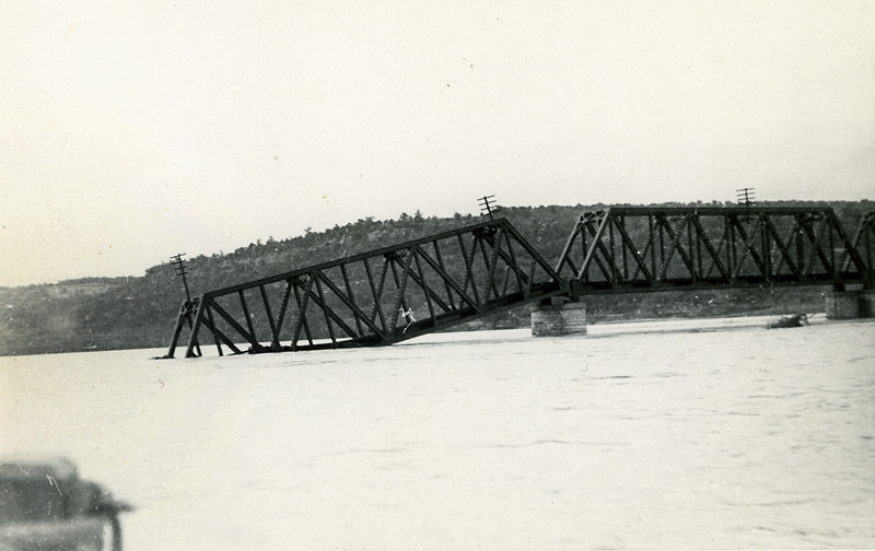
Flood of Spring 1943
| Newspaper accounts say that the "1943 flood" actually consisted of two separate floods, extremely close together. The first flood occurred in mid May. The southern approach to the Frisco bridge washed out. When pier 10 was undercut and went with it, this collapsed the southern end of the last span (#8) into the River on Wednesday May 12. (This "first flood" crested at 41.7 feet at Fort Smith on May 12.) The southern approach to the Van Buren Free Bridge washed out also. During this flood Frisco employees probably saved the bridge by walking across it from Van Buren and cutting the rails between the bridge and the approach shortly before the approach washed out. One newspaper account states that this first flood also destroyed the "support blocks" on the Van Buren side allowing the beams of the first span to drop directly onto the supporting piers. This "first flood" crested at 41.7 feet at Fort Smith on May 12.
After the "first flood" the missing southern approach to the Free Bridge was replaced with a temporary pontoon bridge, primarily to restore Fort Smith's water line connection with Lake Fort Smith. The "second flood" occurred before the water completely receded and much could be done about the damage which was already done. The crest at Fort Smith this time was 38.8 feet on May 23. This was the flood which apparently finished off the first span (Van Buren side). This "second flood" also destroyed a large section of the pontoon bridge which had temporarily restored water to Fort Smith. The Press Argus ran an article on 13 Aug 1943 discussing the Frisco's rebuilding project. Frisco was replacing it's southern approach trestle to the Frisco Bridge with what some considered a "stone dam". It was apparently felt, by a number of individuals and groups, that the project was placing both Van Buren and Fort Smith in even greater danger should another flood of equal or greater magnitude occur. The Frisco felt obligated to explain what it was doing, which it did in an article published in the Argus on 20 August. "We are not building any more of a dam across the river than was there originally. You are probably under a misapprehension as to what our plans actually contemplate. We are filling in 700 feet of trestle at the extreme south side and raising the grade line, but we intend to extend the steel work of the bridge 250 feet beyond what it was before by placing an additional 300 foot span and one 50 foot span and we believe this will be sufficient to take care of any flood and with this permanent opening of 350 feet added on the south side of the river, pressure on the Van Buren side ought to be materially relieved. J.M. Kurn" (NOTE: Where the article earlier says "250 feet beyond" is probably a typo and it should have read "350 feet") Actual water levels at Van Buren during the 43 floods included: There was a slow drop from this point until the River reached 27.8 feet on May 18 From then the River slowly rose again until it reached a crest of 37.1 feet at 3 PM on May 23. |
Researched by John Dill |
 |
 |
Contributed by Bill Pollard |
 |
Contributed by John Dill |
| Figure 10. This photo shows a straight top chord span on the Ft. Smith side of the bridge that was washed out during the 1943 flood. |
 |
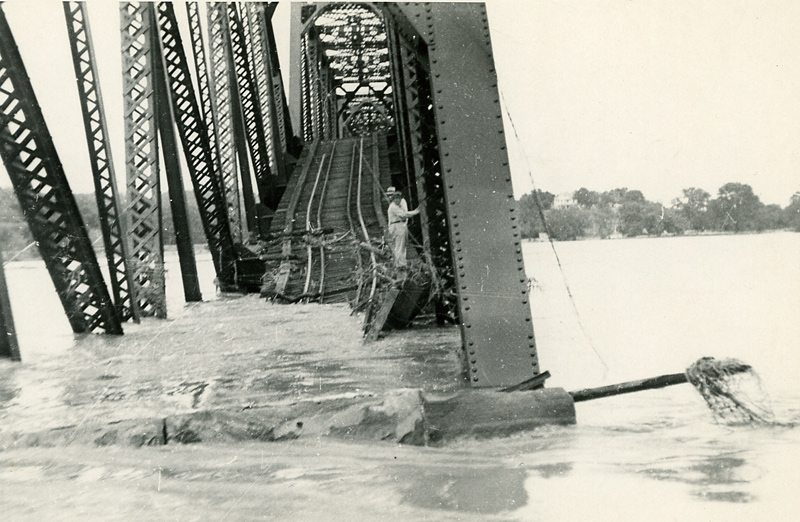
Contributed by John Dill |
Figure 11. This image appears to show the temporary trestle built to aid in the erection of the replacement span after the 1943 flood. It appears that the steel stringers for the replacement are already in place under the train. A new concrete pier is being constructed under the boom of the bridge crane. |
Phase II: after 1943 rebuildingwith deck girders on north |
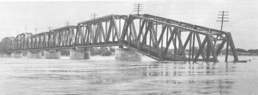
| The flood in May of 1943 resulted in the lost of the abutment on the south end of the bridge , resulting in the south end of Span 8 dropping into the river, see Figure 8. Span 1 on the north end was lost. During the repairs, a 300' through truss span and a 50 through plate girder span, see Figures 23 and 24, were added to the south end and 4 deck girder spans, see Figure 15, were used to replace the lost Span 1 on the north end. The rebuilding of the bridge took several months based on the account in the Argus of Aug. 20. |
 |
Contributed by H. E. Huber |
Figure 13. Work train on the Second Frisco bridge. The north end of the bridge lost one span during the 1943 flood. The last span in this picture has a curved top chord. The second bridge originally had 4 straight top chord spans on the Ft. Smith side of the river. This picture shows 3 straight top chord spans, thus this must be of a later flood. |
 |
Jack Avery Photo |
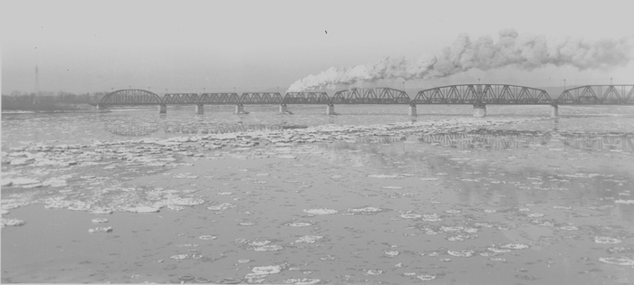
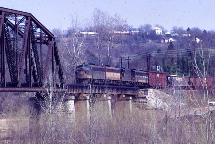
| Figure 14. Frisco 2-8-0 #1332 leads a freight across the reconstructed bridge in January 1947. |
 |
Mike Condren Photo |
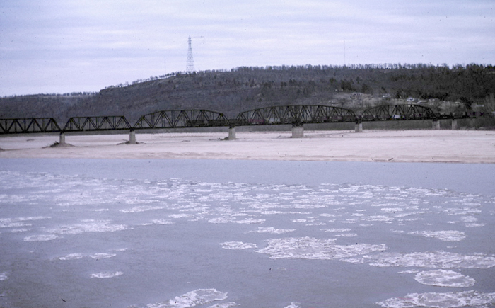
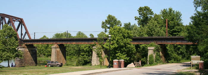
| Figure 15. This view of the Frisco's second bridge shows the deck girder spans on the Van Buren side that replaced a lost span after the May, 1943 flood. Note that the channel in this January, 1963 photo is against the Ft. Smith bank . Also note the ice flows. |
 |
 |
Mike Condren Photos |
Figure 16. These views show Span 2 of the 1914 bridge and pier 2 of the 1885 bridge. |
 |
 |
Mike Condren Photos |
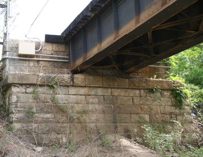
| Figure 17. The top image shows the plate girder replacements for the span that was lost in the 1943 flood. The bottom image shows the north abutment to the bridge. This appears to be part of the original 1885 bridge. |
Phase III: with vertical lift span
 |
Contributed by John Dill |
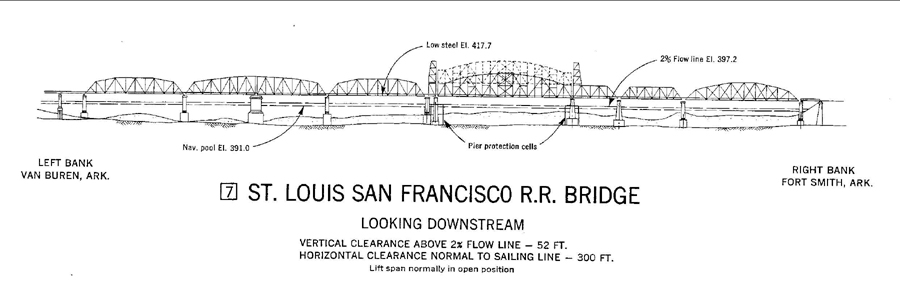
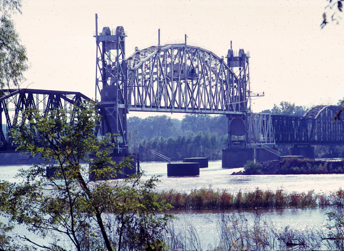
| Figure 18. The navigation diagram of the Frisco bridge, looking downstream, of the bridge following the completion of the navigation project. |
 |
Contributed by John Dill |
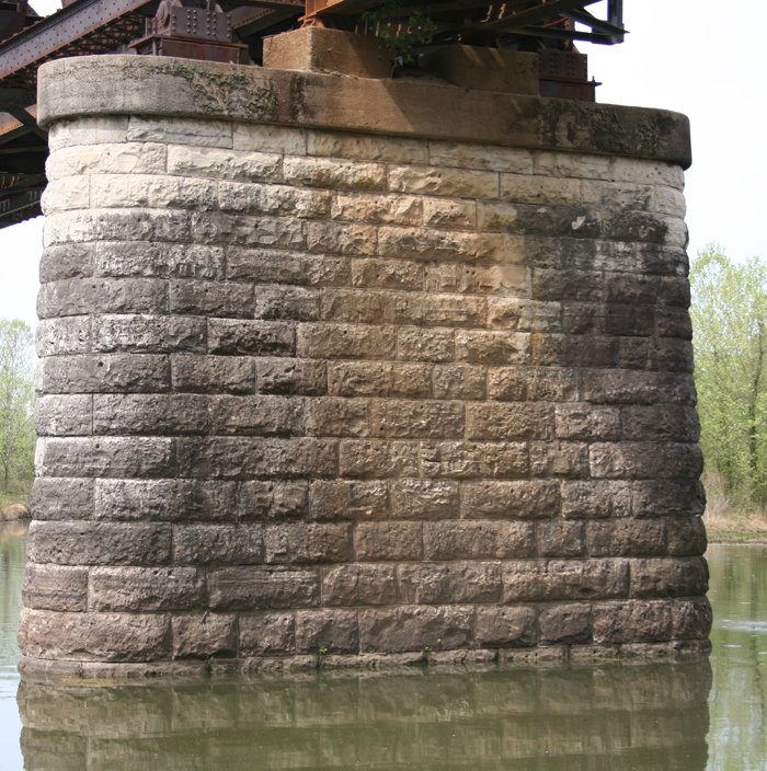
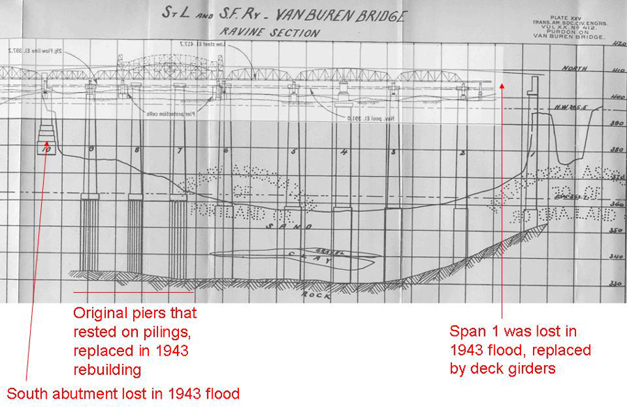
Figure 19. The navigation diagram of the Frisco bridge overlaying the 1889 document showing the location of the piers. Some of the original piers still stand, those stone piers on the Van Buren side of the bridge. Figure 15 shows the stone piers on the north end that are still in place. Figure 16 shows the concrete piers that support the deck girder section of the bridge. Figure 19 shows the southern most pier before the vertical lift span is still one of the 1885 stone piers. All of those south of that pier are now made of concrete and are assumed to be resting on the rock formation under the river. |
 |
Mike Condren Photo |
| The SL-SF bridge was redone for the navigation project by Fag an electrical company. Harrington & Cortelyou of Kansas City was the consulting engineers. General Electric supplied the electrical equipment through the distributor Southern Electric, Inc in Fort Smith. The Signal Equipment (horns) was designed by Clark Cooper Signal Division or the Wm. Hagan Company., Palmyra, NJ. The Horn is a Herald Model H621. The horn specifications are, Range - 2 miles, pitch - 170 CPS, Sound Level - 117 DBS, Air Consumption .96 cu.ft./sec., Mounting 4 1/4 flange, connection - 1/2" npt. |
Contributed by Bradley Martin |
 |
 |
 |
 |
 |
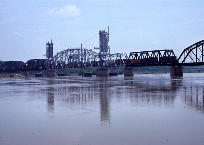
Mike Condren Photos |
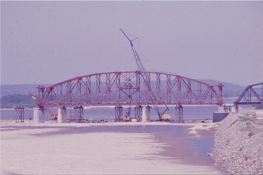
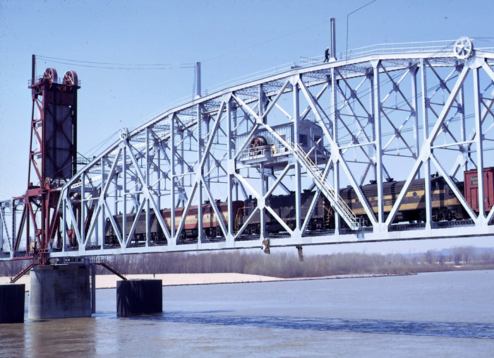
Figure 20. Train 731 is crossing the nearly complete Phase III of the Arkansas River bridge, 3/28/70. |
 |
Mike Condren Photo |
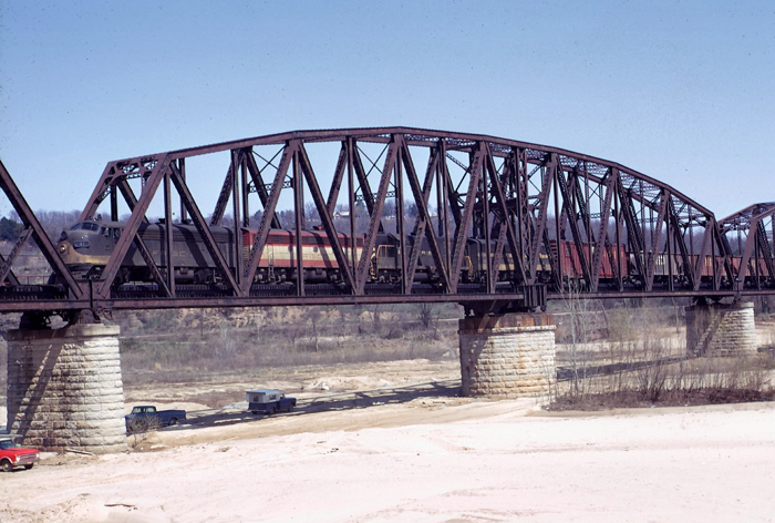
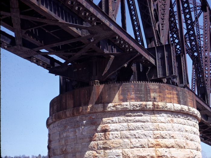
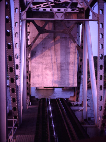
Figure 21. This is the turn span of the second bridge at this location. |
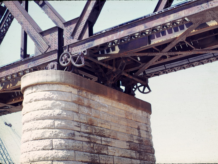 |
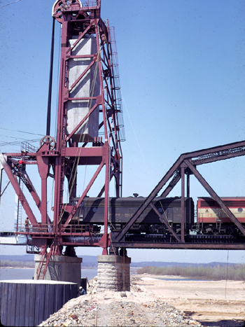
Mike Condren Photo |
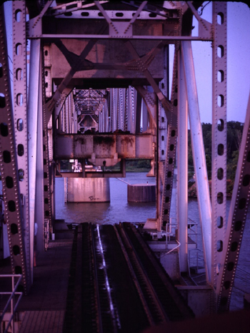
Figure 22. Locking mechanism for the turn span of the second bridge. The crane to the left is erecting the towers for the new left span |
 |
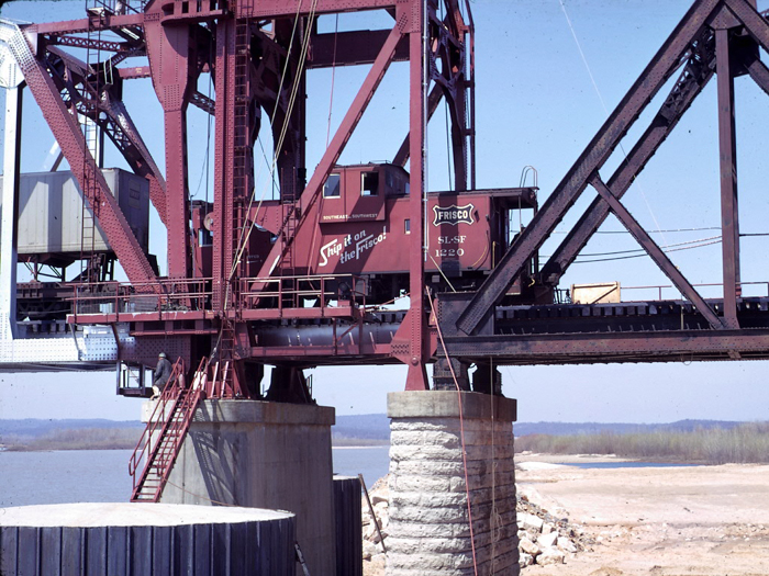
Mike Condren Photo |
Figure 23. The McClellan-Kerr Arkansas River Navigation System navigation project resulted in the removal of the Iron Mountain bridge. The Missouri Pacific then returned to using the Frisco bridge from Van Buren to reach Ft. Smith. Here we see the MP AC Local crossing the bridge toward Ft. Smith. |
 |
Mike Condren Photo |
| Figure 24. As part of the McClellan-Kerr Arkansas River Navigation System, a new vertical lift span was installed in the location of the new channel. This required removal of three of the old spans and replacement by the lift span and the short silver span. |
 |
- |  |
Mike Condren Photos |
Figure 25. From a locomotive cab, we see the counter-weight down and then part way up taken from the engine sitting on the 1/2 span on the south side of the lift-span. |
 |
John Dill Photo |
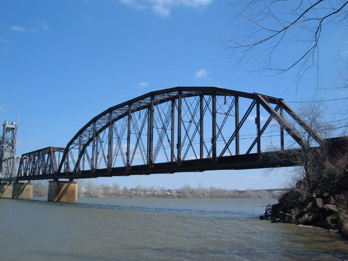
| Figure 26. The 300' span on the south end is an addition to the bridge after the 1943 flood. |
 |
John Dill Photo |
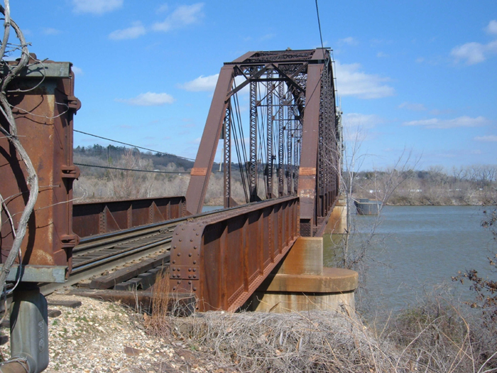
Figure 27. The short 50' span on the south end is an addition to the bridge after the 1943 flood, making the bridge 350' longer than the original 1885 and the 1914 versions of the bridge. |
This site is maintained by the Arkansas Boston Mountains Chapter of the National Railway Historical Society located in Springdale, Arkansas


Home of THE ARKANSAS SCRAMBLER
For questions, email arkyrail at outlook.com