Trip to Southern Illinois:
Southern Illinois wanderings,
Carbondale to Shawneetown, Cairo,
Kaskaskia, and Okawville
Sept. 10-11, 2011
Photos by Dave Ingles
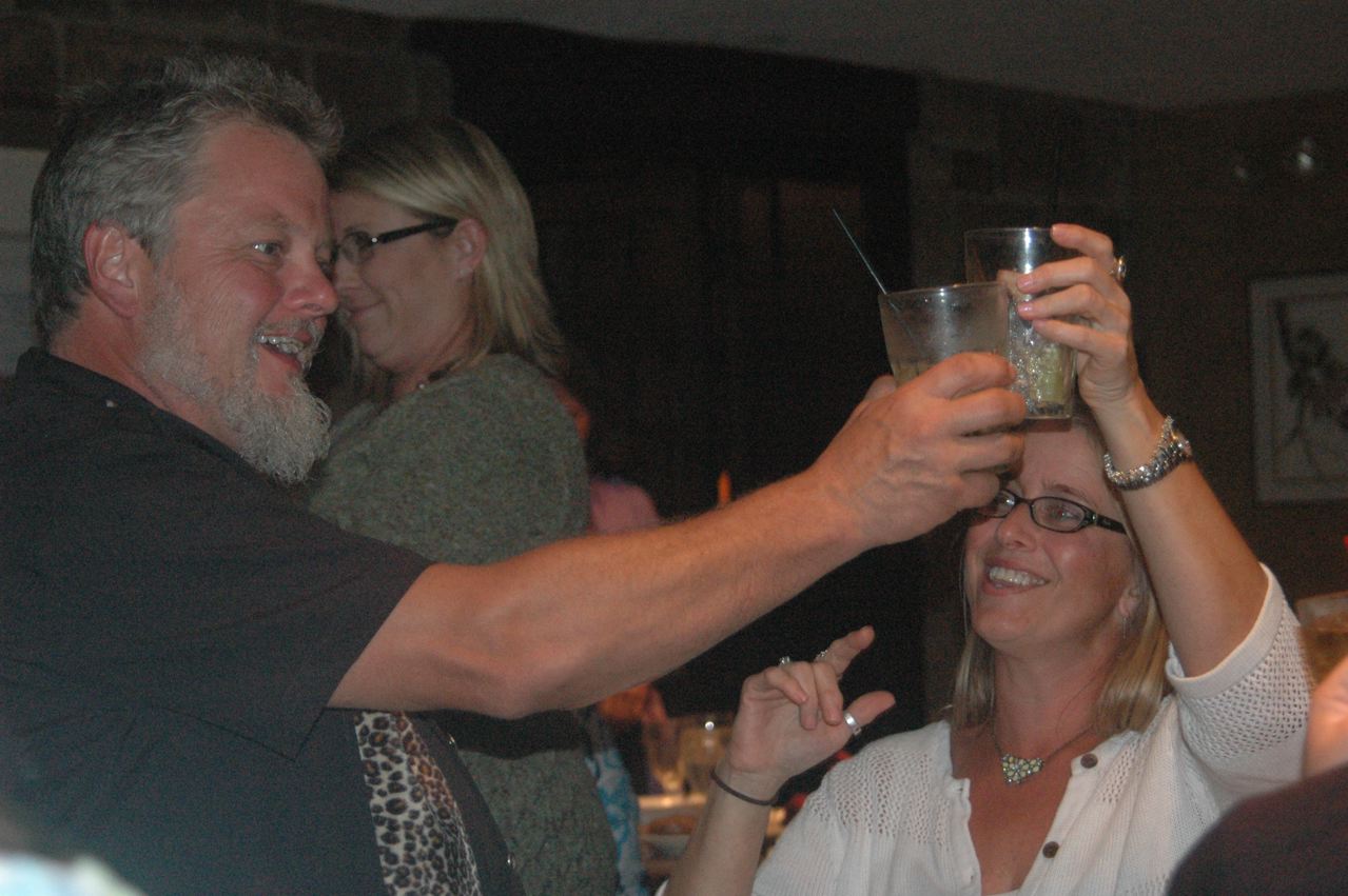
| Before we resume our travels, permit a couple of "people photos" of the event we drove south for. At Friday night's rehearsal dinner, Saturday's groom and bride, Jeff Wallin and Valerie Brooks, toast each other. The dinner was at the archetypal rustic lodge at Giant City State Park about 10 miles south of Carbondale. |
 |
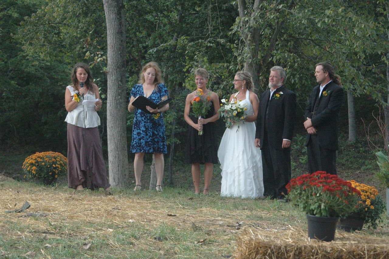
| At the ceremony itself Saturday afternoon on Jeff Wallin's 12-acre "ranch" in the woods at Mountain Glen, 3 miles west of Cobden (on CN's IC main line, the Amtrak City of New Orleans route, about 15 miles south of Carbondale), Jeff's sister Kymm, from California, at left, does a reading. The bride and groom are 4th and 5th from left, flanked by the maid of honor and best man, with the officiant 2nd from left. |
 |
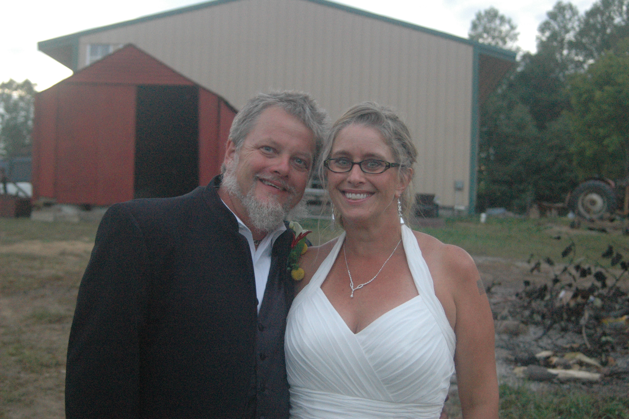
| After dusk, as we were departing, Jeff and Valerie Wallin posed for a photo. |
 |
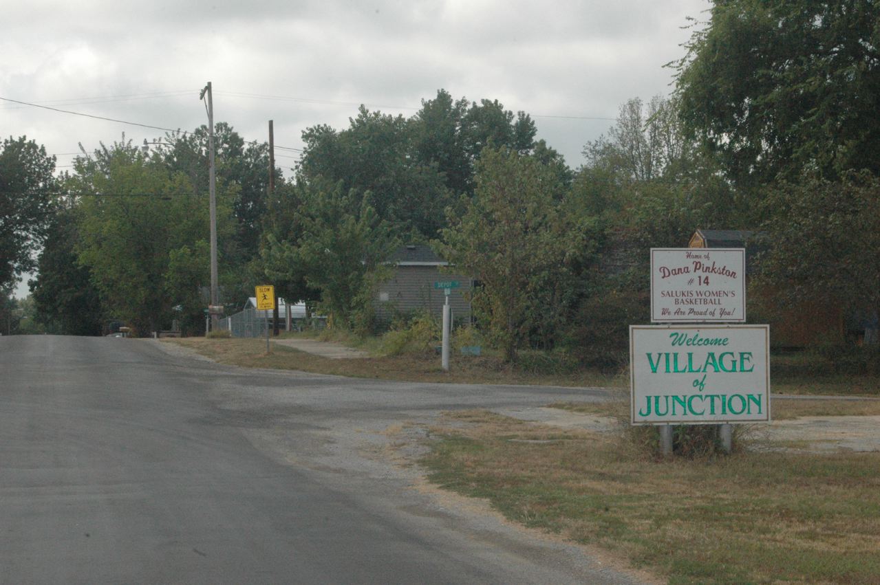
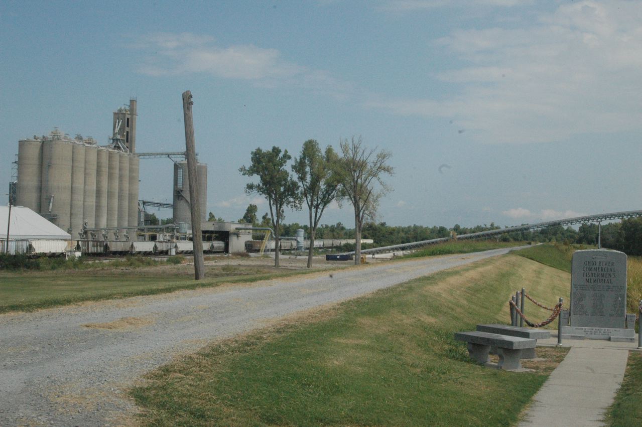
| Having Saturday morning and midday free until the 4 p.m. ceremony, Carol and I drove east to Shawneetown, one of Illinois' earliest incorporated communities (if not the first), on the Ohio River, a historic Illinois point we'd never visited. After the big 1937 Ohio River flood, the town relocated 3 miles inland. Shawneetown in the "classic era," although there never was a rail crossing to Kentucky, was at the end of what had become two obscure branch lines: B&O's that went north through Flora (on the Cincinnati-St. Louis main line and Springfield to Beardstown, on the Illinois River, B&O's westernmost point; and L&N's, which connected to its Evansville-St. Louis line at McLeansboro. Probably both were built from the river northward, but I haven't researched it. Coming from the north, these lines met at what became the small community of Junction, Ill., which we explored but could find nothing really evident of the long-gone rail lines to photograph. From the SPV (not always reliable), the lines originally crossed just west of here (to our right), but at some time L&N went onto B&O trackage rights from here east. In this photo at the north end of town, looking south, the first right of way, which I THINK was B&O's (unless they crossed EAST of the community), was where the paved street is, with the L&N's track on the slight rise just beyond the Slow School sign. Google Earth aerial photos are not conclusive, but from here east, there is only one evident right-of-way to Shawneetown, parallel to and just south of Route 13. The B&O line in its latter years was the Prairie Central Railroad; I believe David Morgan and Phil Hastings encountered a 2-8-0 on the B&O branch in the late 1950's. |
 |
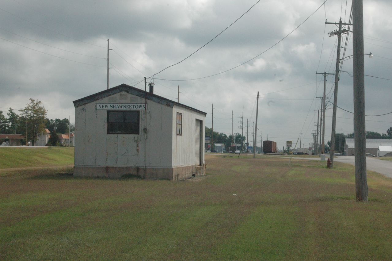
| In the 1937 re-settlement, B&O called the site New Shawneetown, and I was astounded to see the "depot-ette" intact. Route 13 is on the rise at the left edge of the photo. We look east-southeast toward the Ohio River alley. |
 |
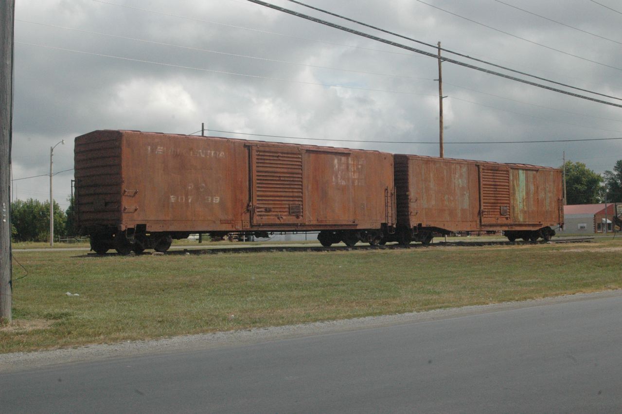
| Likely remnants from the era of the Prairie Central, a Craig Burroughs enterprise which didn't last long, two former Penn Central boxcars are "on display," possibly on a piece of original track. The one at the right last wore New York Central markings, and both were jade Green. |
 |
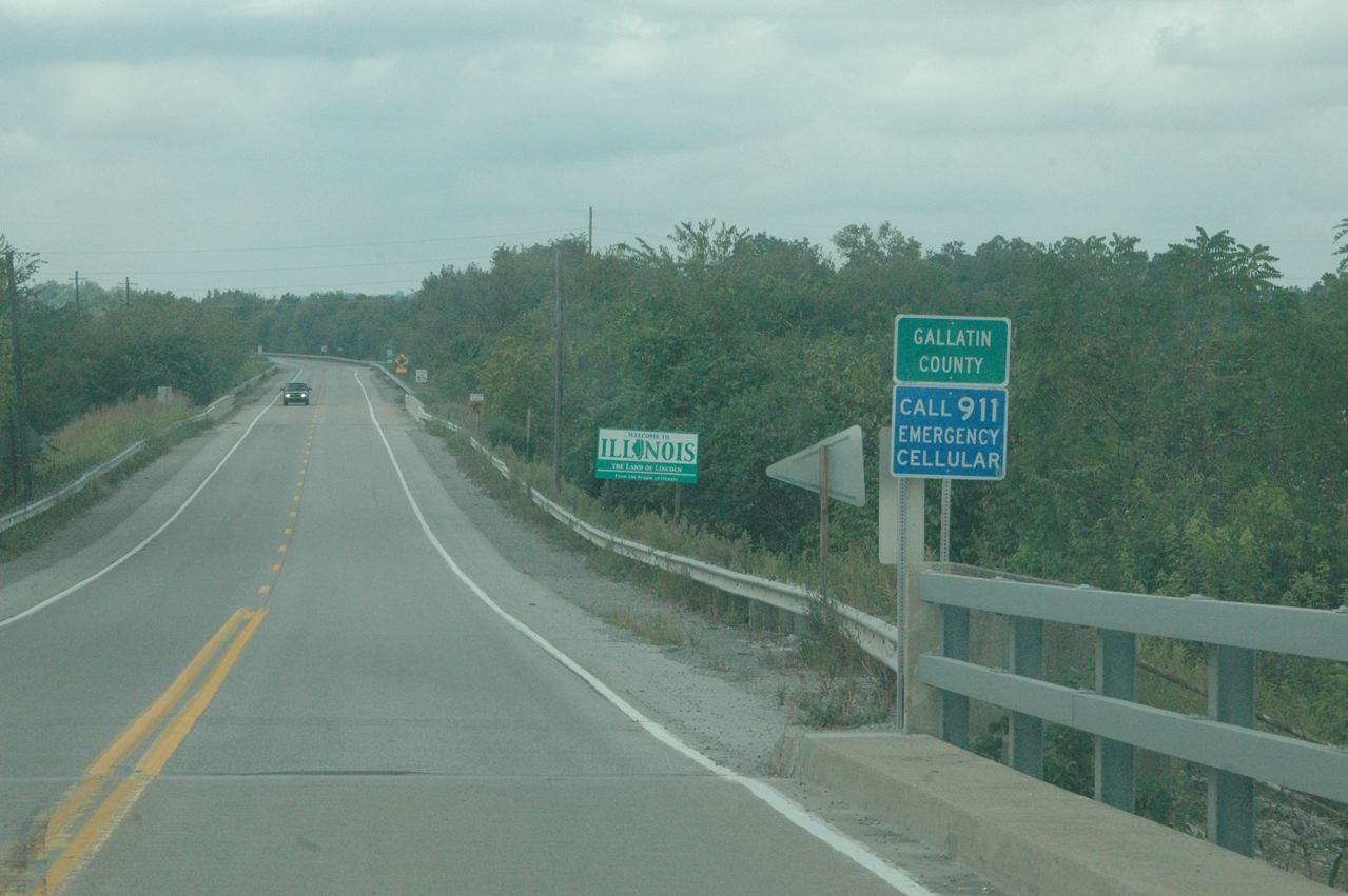
| We drove into Kentucky a couple miles just to say we did it, and found not a single sign with "Kentucky" on it, even on the commercial establishments at the first highway junction. There is no real community on the Kentucky side. Here we re-enter Illinois, and are about to explore Old Shawneetown for a few minutes; it appears to have 100 or so residents, but "Hogdaddy's Bar," apparently the commercial magnet in the community, is closed. |
 |
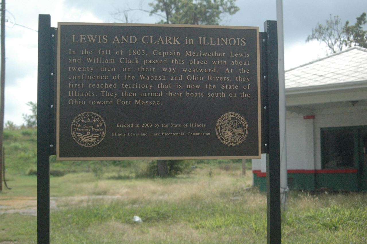
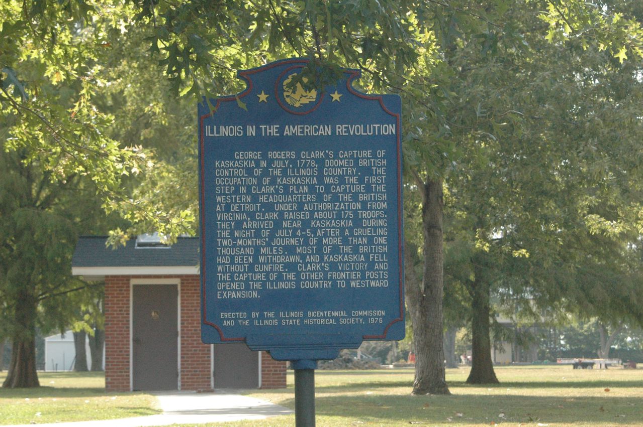
| In Old Shawneetown, next to a former corner gas station, is this plaque. |
 |
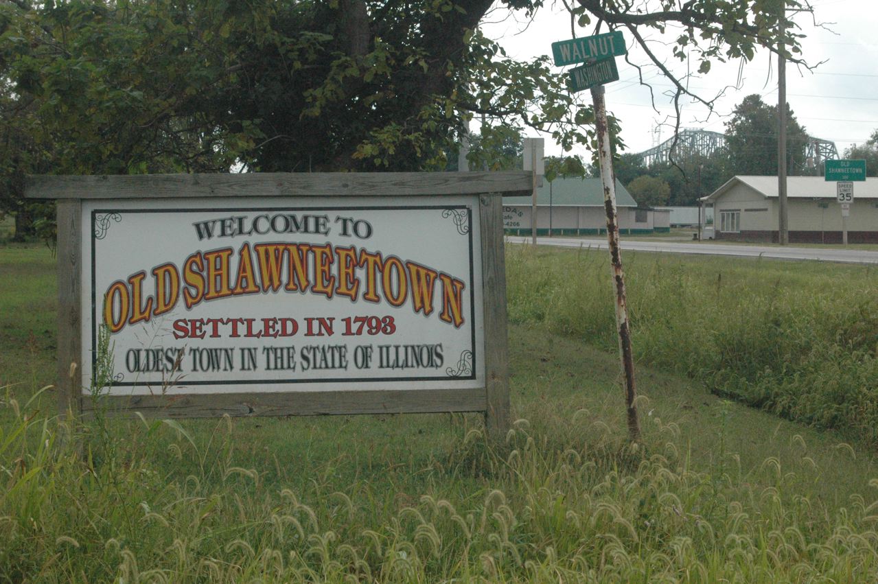
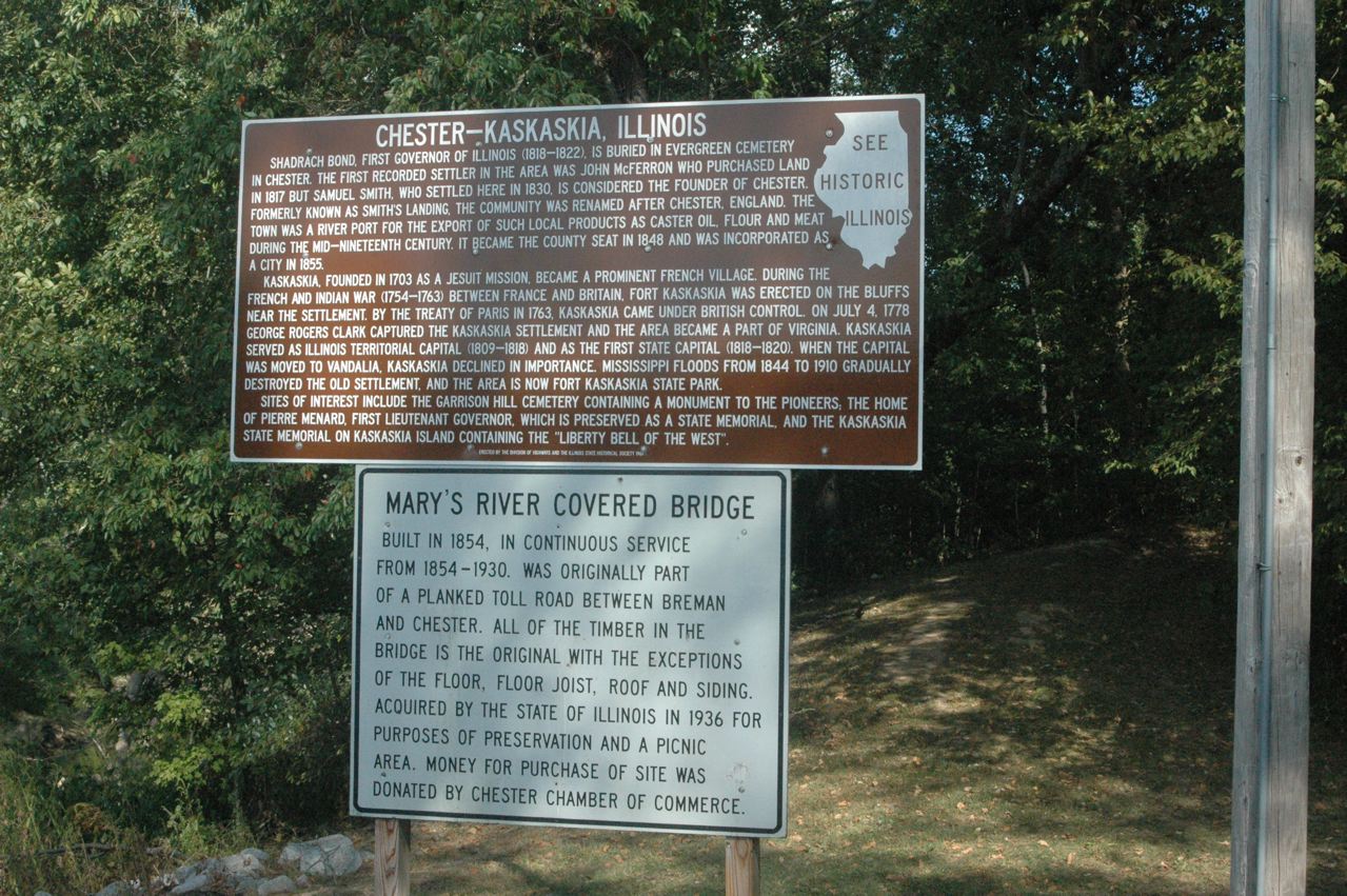
| At the west side of the community -- which like the river-edge area in Prairie du Chien, Wis., on the Mississippi, still has a complete street grid -- is this sign, at Walnut and Washington streets. The old highway is visible at right, and the highway bridge to Kentucky at far right in the distance. We are not sure, but we think the sign means "first incorporated town," as there were others -- Kaskaskia, for example, the first (and just briefly) state capital, on the Mississippi, was first settled by Jesuit missionaries in 1703. Illinois Territory dates from 1809, and it became the 21st state in 1818. |
 |
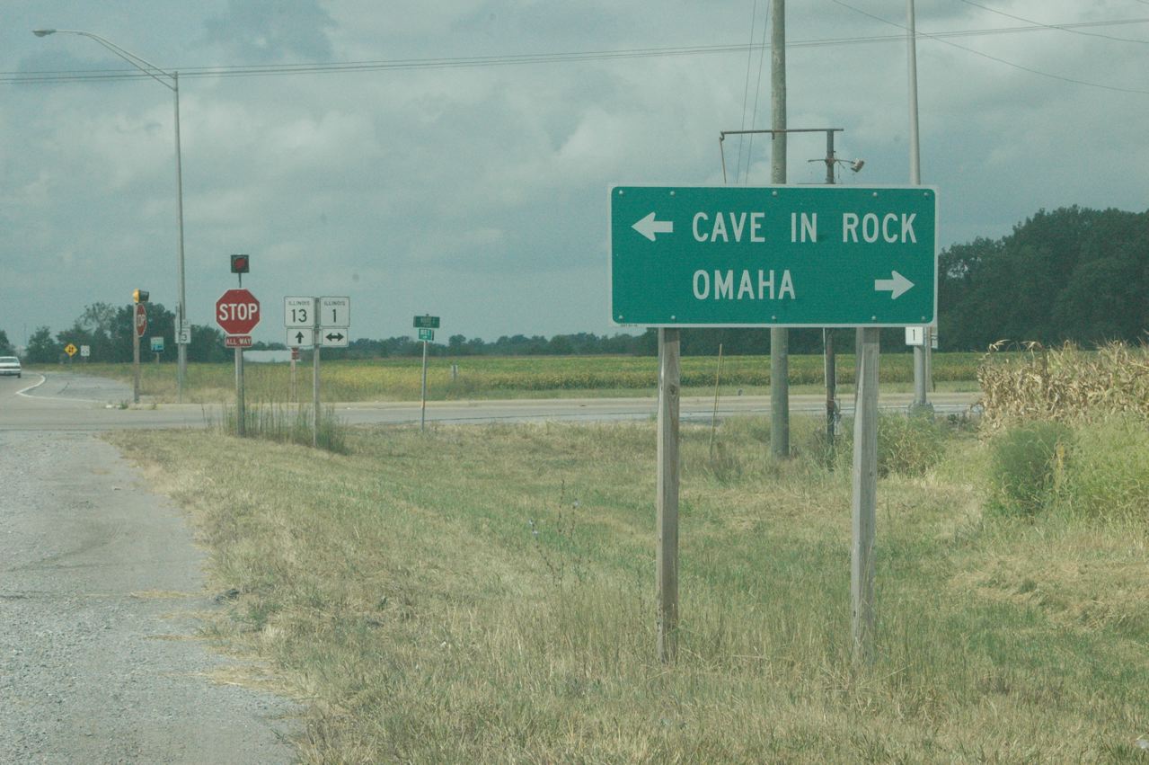
| You are not in Nebraska, that's for sure. Route 1 goes from Chicago south, hugging the Indiana border, all the way to Cave-in-Rock, on the Ohio River, where you can take a free ferry to Kentucky. We did that in 2003. |
 |
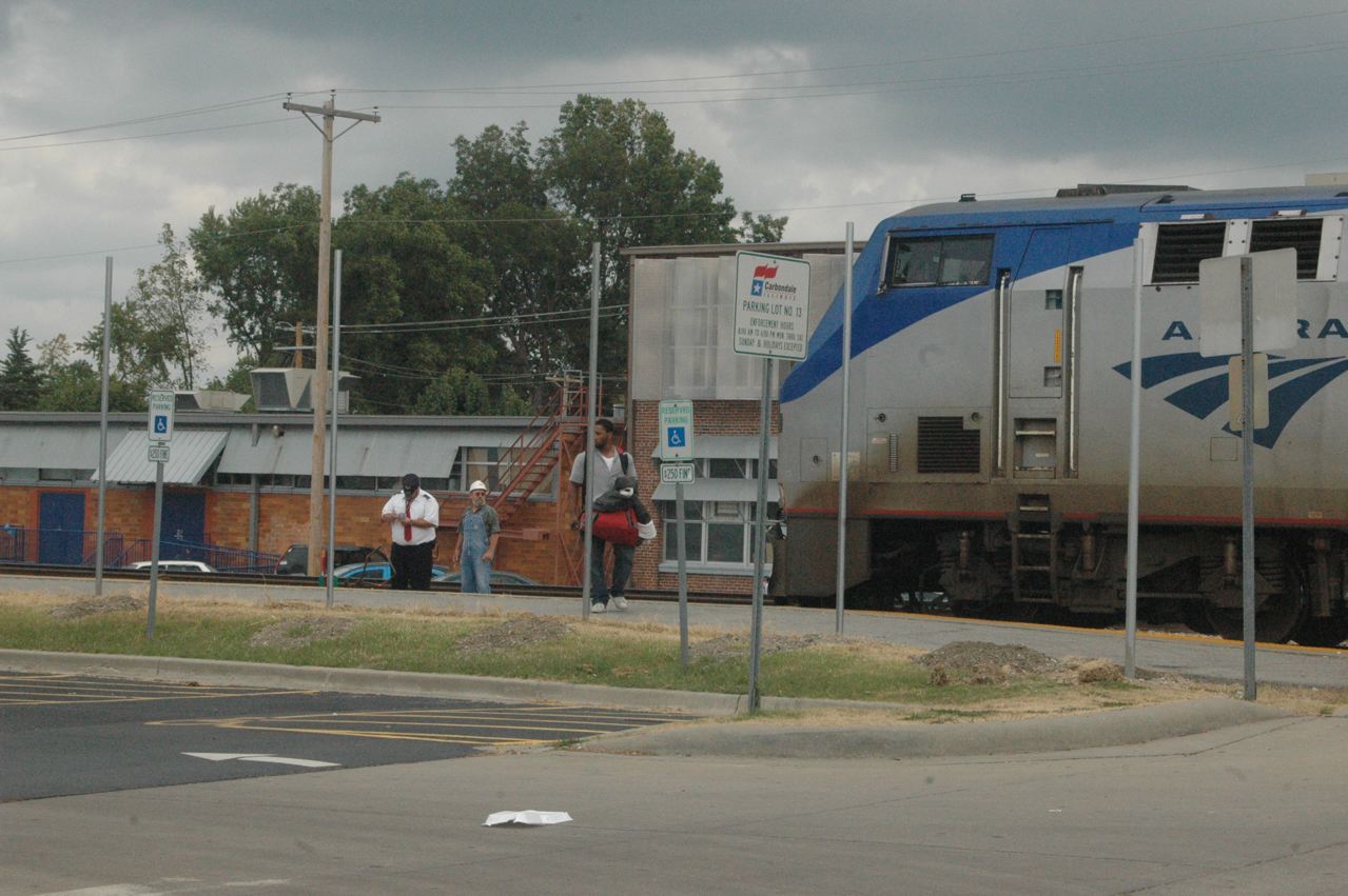
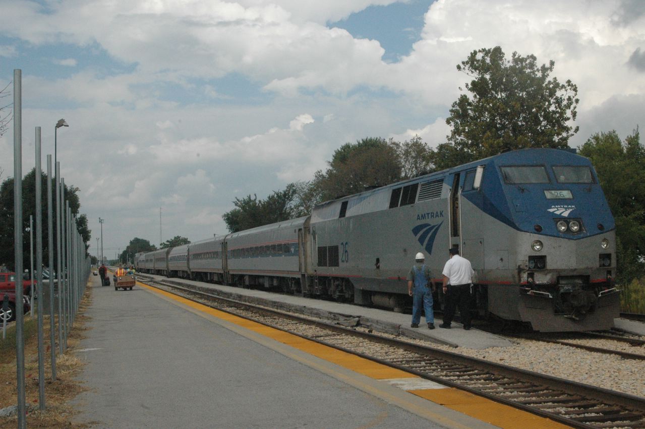
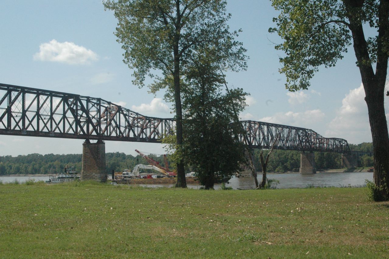
| Back in Carbondale, we arrived downtown just after the Saluki had arrived from Chicago and unloaded. We watched it pull off the west main of the two main tracks and tuck itself away into the pocket center track in front of the depot. |
 |
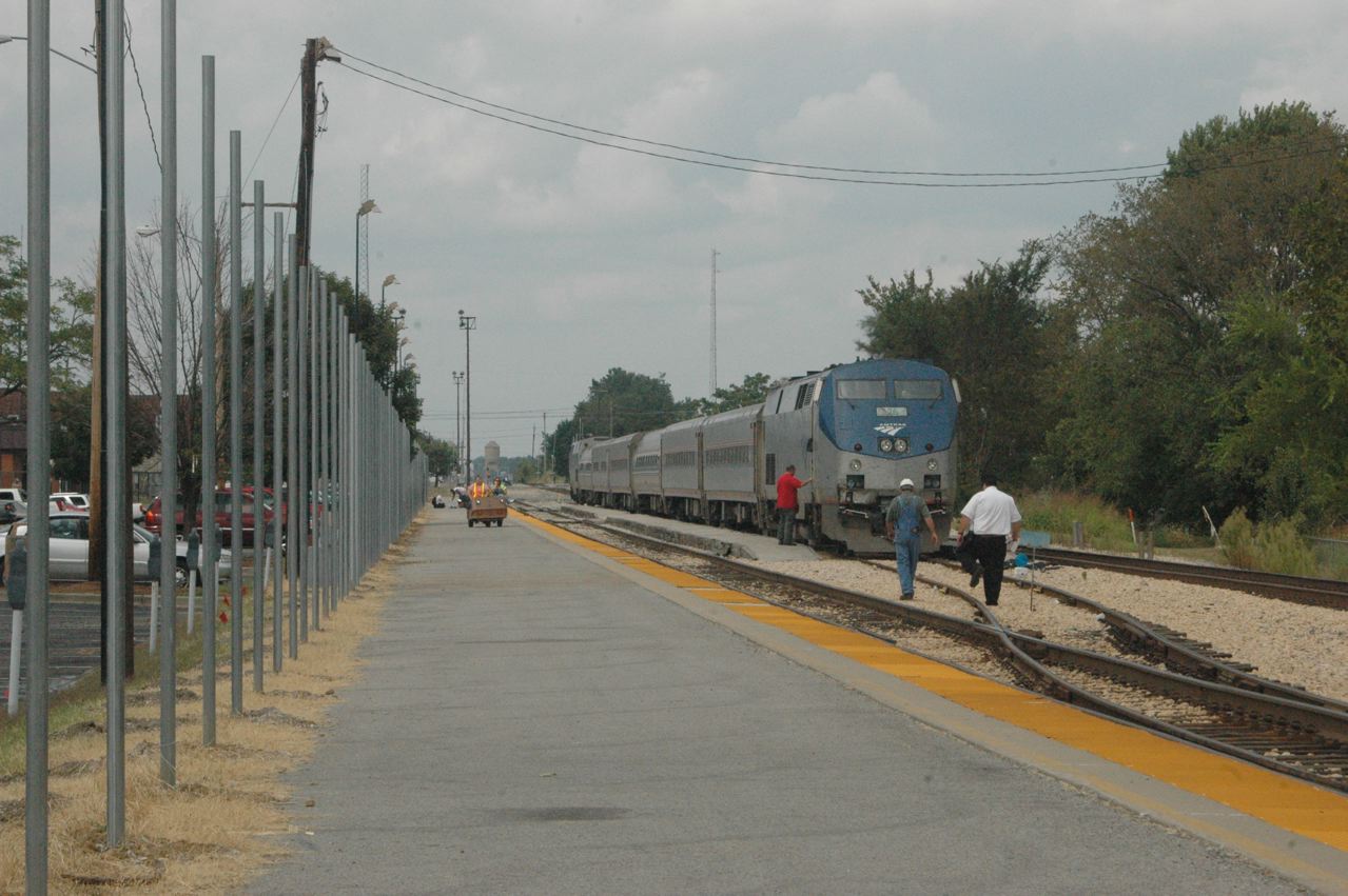
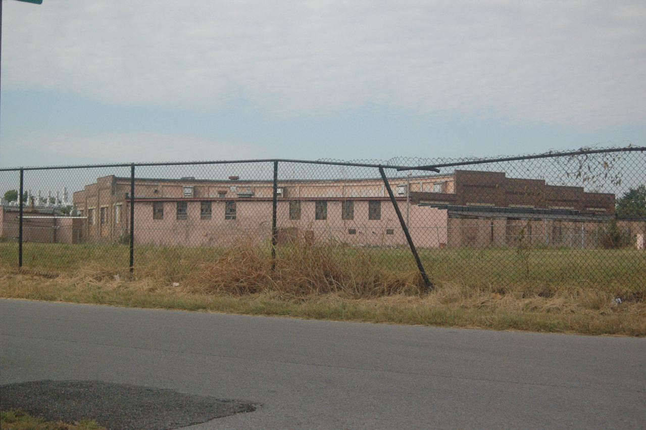
| It looks like there soon will be a fence between the parking lots and the platform. Homeland Security nonsense, perhaps? |
 |
 |
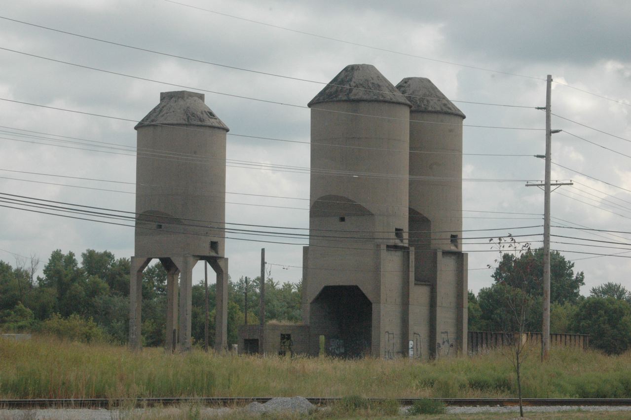
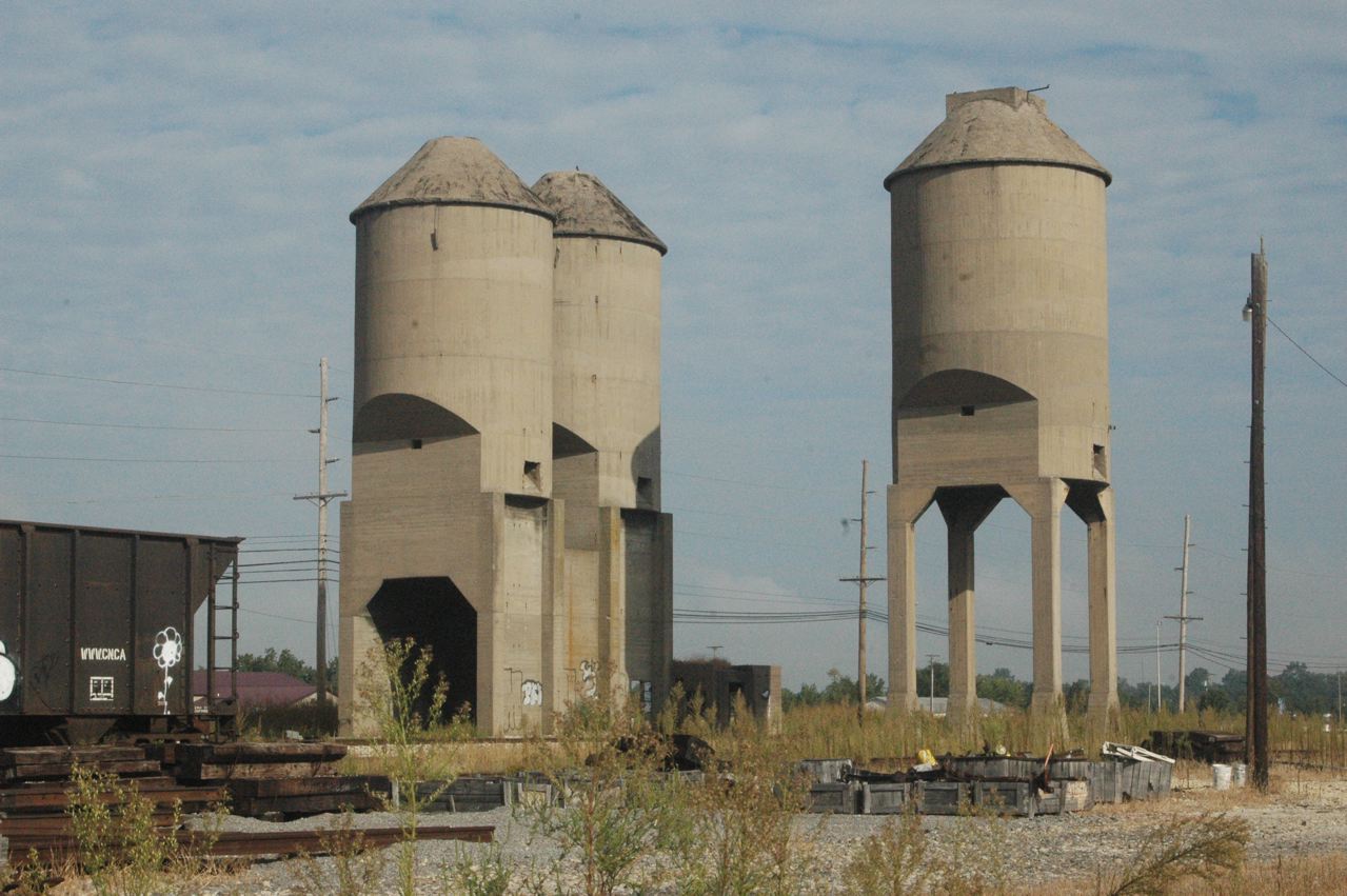
| In the north end of town, all traces of the IC division point with a yard and roundhouse are pretty much gone, except for these concrete coal towers. There is still a wye in this vicinity, for Amtrak, although these days the trainsets seem to have a P42 engine at each end. |
 |
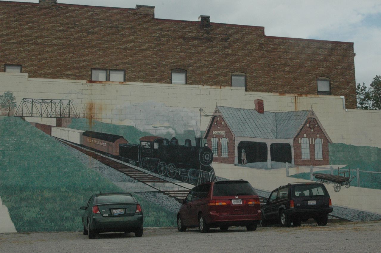
| In Cobden, on our way to the wedding, we found this mural. The depot itself is long gone. CN runs a few freights thru here on the main line, and the bridge pictured (replaced by a new span years ago) gives a good vantage point, but we saw or heard no trains during our time here and at the wedding. |
 |
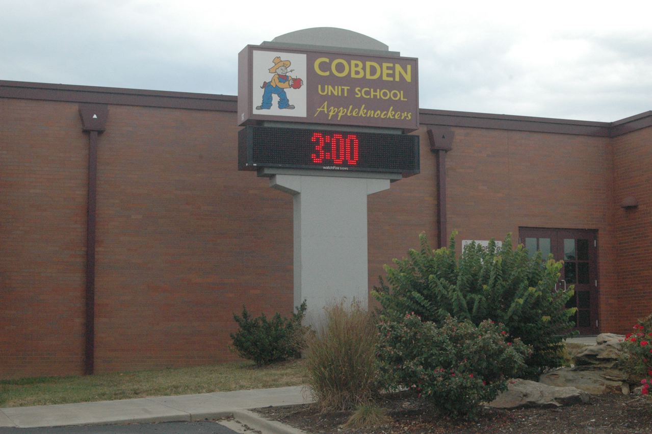
| Illinois has had two versions of Indiana's "Hoosiers" in high school basketball. In 1952, tiny Alden-Hebron High School, with 98 students in Hebron, next to the Wisconsin border, defeated mighty Quincy, 64-59 in overtime, to claim the state title, and in 1964, the Cobden Appleknockers got to the final game before losing to larger Pekin, 50-45. This was in the era when all teams competed in one tournament, no separation by size or "class." The school still exists, with the building modernized, and in fact its girls softball team recently won three straight state titles in Class 1A, the smallest school. |
 |
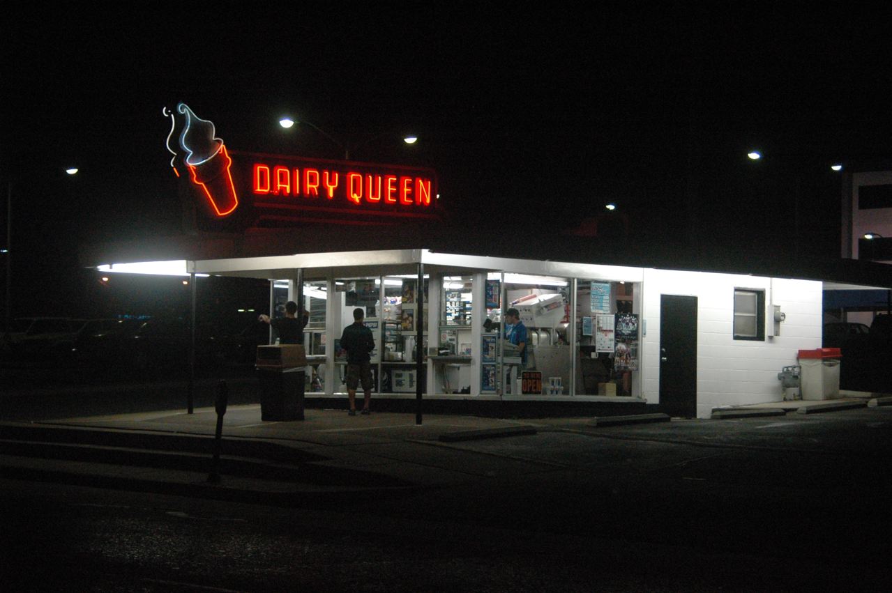
| In the evening after the wedding and reception, we stopped here for dessert in Carbondale. Carol likes their no-sugar-added offerings. |
 |
| Sunday, Sept. 11, dawns sunny, and we begin our "wandering" with these photos in Carbondale. During our entire time in town, we neither saw nor heard any CN freights, only an Amtrak or two. The old IC depot now is a museum (Amtrak is in a newer building a city block south, to the left here), and between it and the main line is this display of a Paducah-rebuilt GP11 and IC "porch" caboose. |
 |
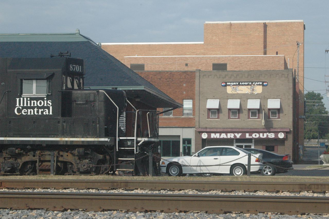
| If you like biscuits and gravy, stop at Mary Lou's cafe sometime, it's their specialty. They close at 2 p.m., however. We had lunch here Saturday, just before closing, and I was first there in 1980 when I was lucky to be invited on a hi-rail ride in an ICG truck down the old GM&O from Murphysboro to Tamms, over Alto Pass, at the time pretty much out of service or close to it, and long since gone. |
 |
| Another view of Carbondale's IC coal towers, from the southeast, opposite of the first view, on a sunny morning from the land that used to contain the roundhouse and other facilities. |
 |
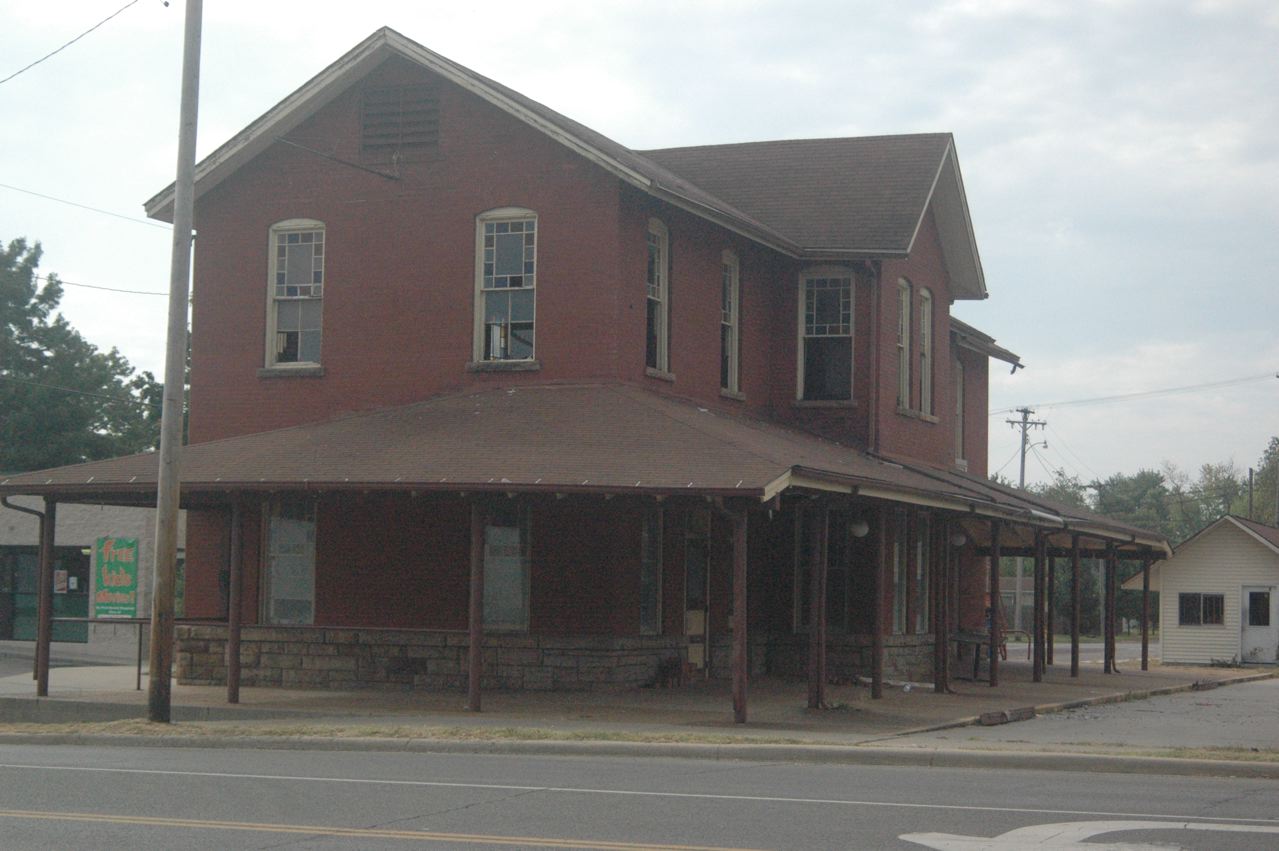
| I've shot it before, when it was a restaurant (and in service, in GM&O and ICG times), but this innocuous building west of downtown Murphysboro, now apparently vacant, not only was the GM&O passenger station, but held the dispatcher's and division offices, upstairs. We look south. |
 |
| We began by going over to "Murphy" to get a better photo of the old M&O/GM&O roundhouse in the north end of town. Without a ladder, you must shoot thru a fence, as the entire (large) property is fenced. I'd not realized it was still standing when last thru Murphysboro in March 2008, but stumbled across it. However, it was late afternoon with hazy sun, so this angle (the best) was looking right into the sun, so I had put this on the "to-do" list for this trip. |
 |
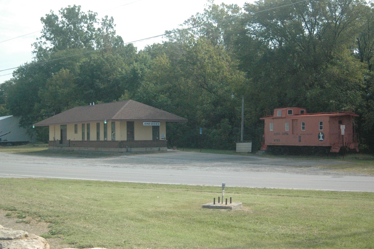
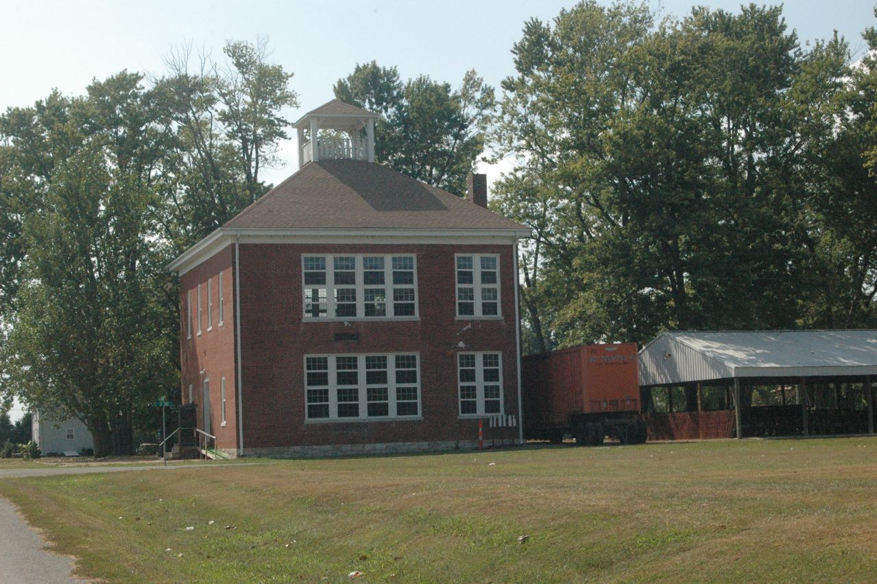
| I was also stunned to see that the Jonesboro GM&O depot had become the city library. It was in slightly deteriorating condition when we hi-railed thru here in 1980. The caboose is ex-IC, of course, not GM&O. |
 |
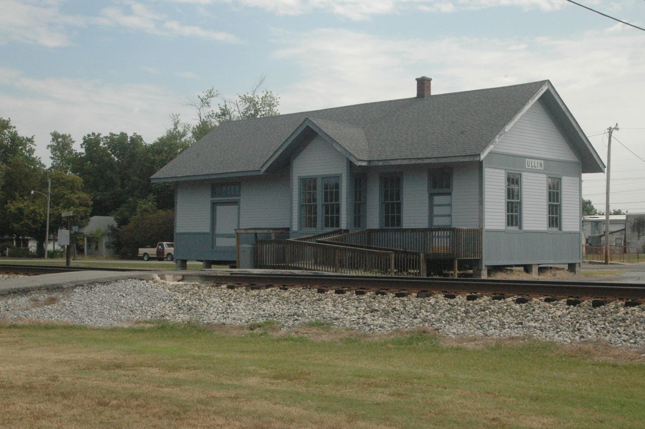
| Ullin, Ill. has preserved this depot by the CN (IC) main line, and the RR Station Hist. Society says this is ex-IC, but to me the architecture is more like C&EI, whose branch to Thebes, Ill., passed thru Ullin on the north side, tho it bridged over the IC main. Regardless, it's in nice shape. |
 |
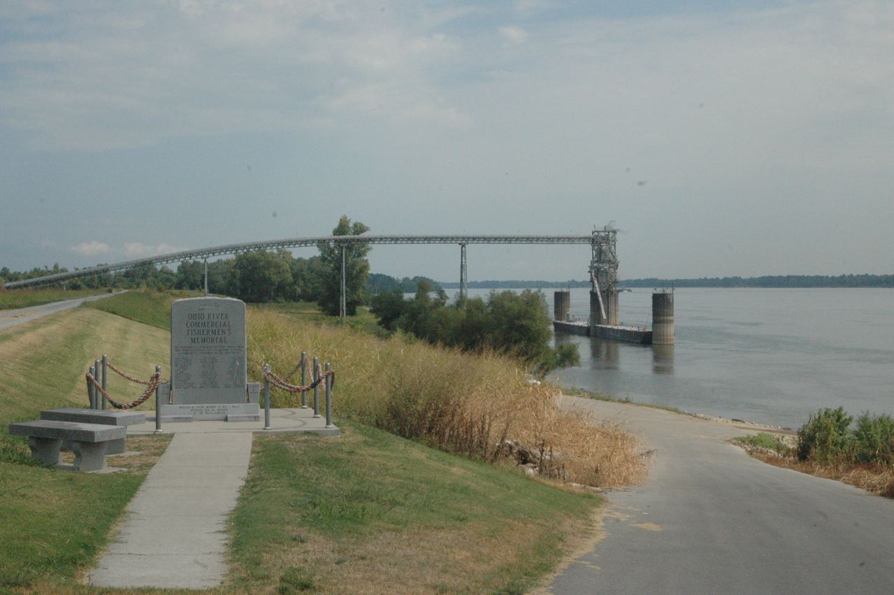
| At Mound City, Ill., we got to the Ohio River again. Two large grain transloading facilities each had an EMD switcher (SW1200 era), but both were parked "inside," this being Sunday. |
 |
 |
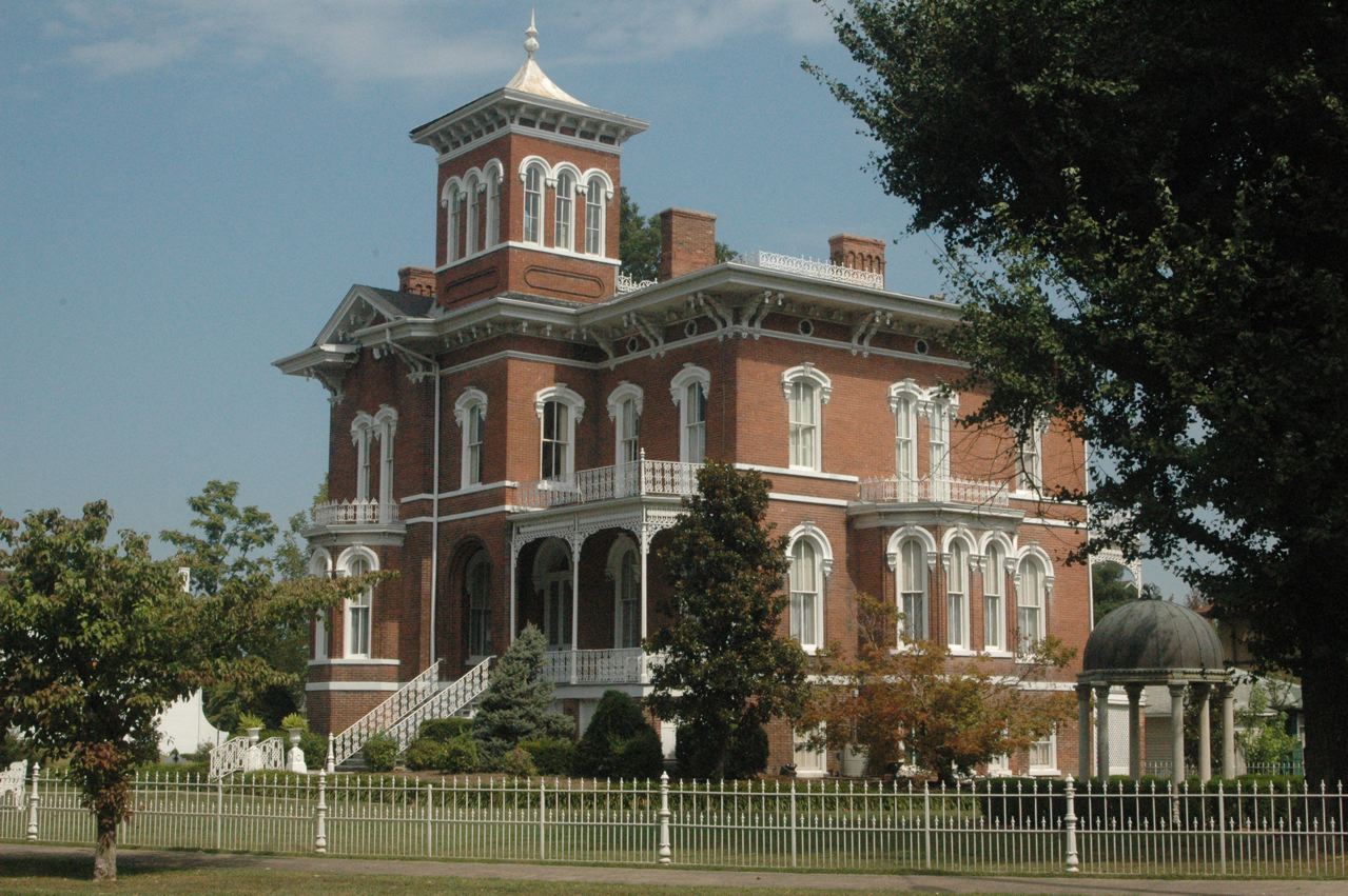
| Cairo, Illinois' southernmost town, is flood-prone, losing population constantly, and has a reputation as a down and out community that looks it. We'd photo'ed depots here years back, but paid a brief visit and found, to our surprise, a neighborhood on a north-side boulevard with some stunning looking homes. This is "Riverlore." |
 |
| Across the street is Magnolia Manor. Some folks here still must have money -- and these are not B&B's or museums, that we could see. There were several others. |
 |
| At the city's north end, where US 45 goes under the IC approach to the Ohio River bridge (and had a floodgate that can close off the road), we saw this engine on the "city lead" that descends from the main line. Apparently whoever has the switching contract for city trackage uses this unit, an ex-CN SW1200RS of the same number. In the "classic days," Cairo was served by IC, NYC's Big Four, MoPac, and Mobile & Ohio (later GM&O). |
 |
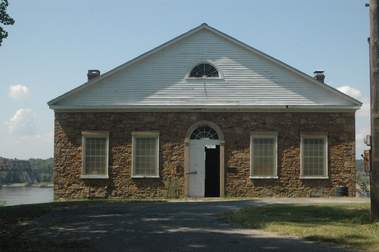
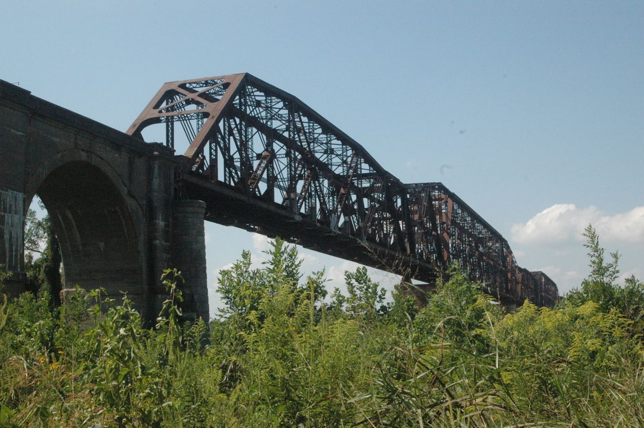
| In 1971 I'd driven into Thebes, on the Mississippi River and site of the big MoPac river bridge, and had photographed a depot down on the river plain that had belonged to C&EI, at the end of its Thebes branch. That is apparently gone, or highly modified, but up in the village is this 1848 courthouse that served Alexander County briefly before the seat was moved to Cairo. Visible at left rear is the MoPac bridge, and just as we found this building, a northbound UP freight was going across. There is no good rail photo angle in Thebes for the UP double track (originally shared by MP and Cotton Belt), just a highway overpass, and I had no time to go back there to try for a routine, and backlit, shot. |
 |
| In searching "below" for the old C&EI building, we did drive underneath the MoPac bridge, which I'd crossed (for the 2nd time) on the "Alabama Explorers" excursion in May 2010 (see separate file). |
 |
 |
| Heading for historic Kaskaskia, Ill., we crossed the Mississippi into Cape Girardeau, Mo. |
 |
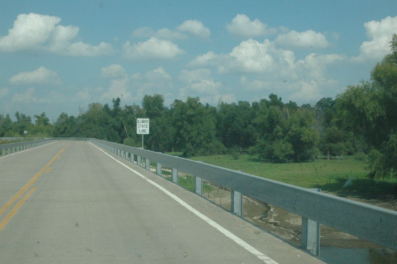
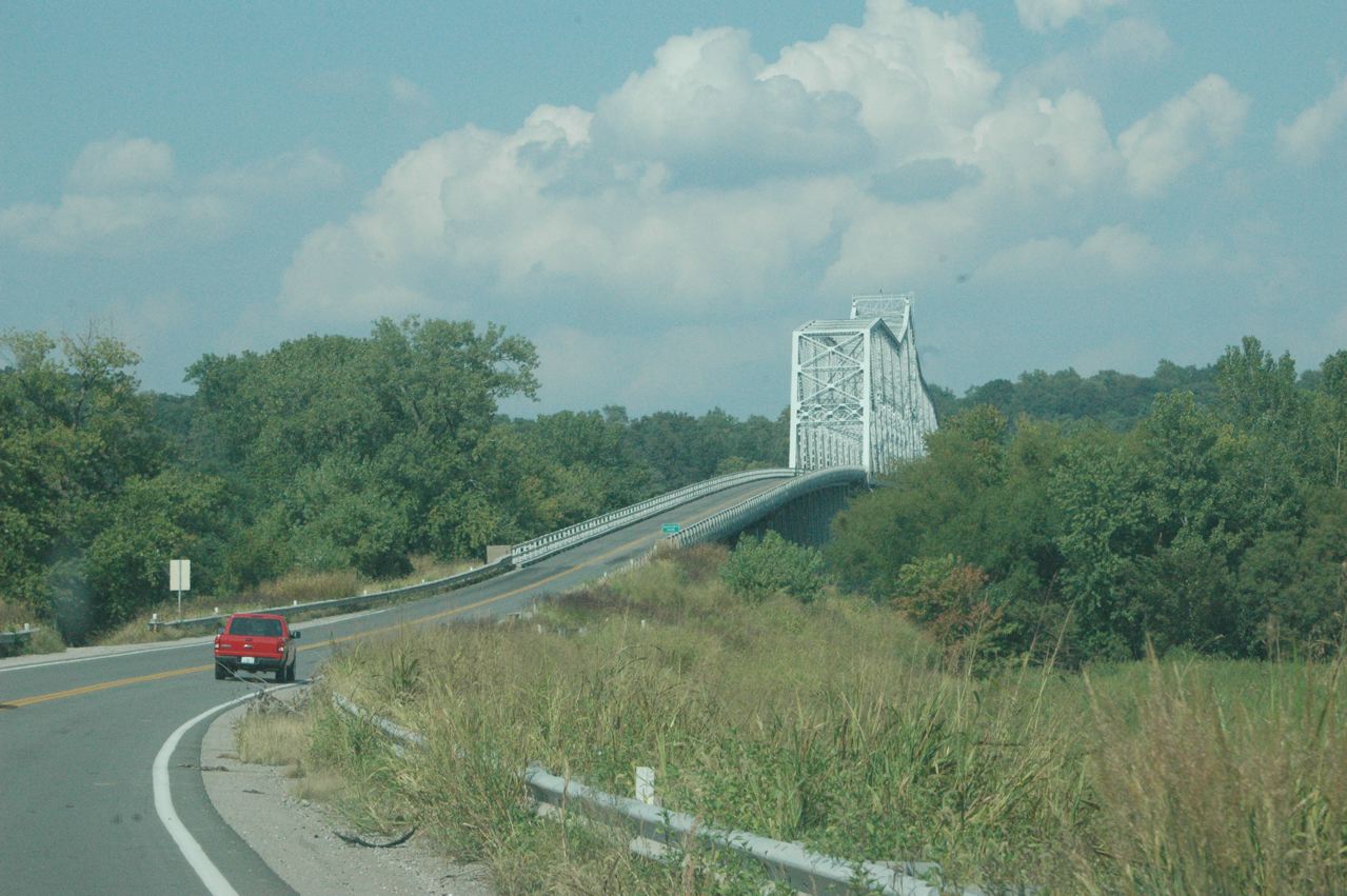
| This is the bridge across the former Mississippi River main channel, now just backwater sloughs, from St. Mary, Mo., to what in effect is the "island" of Kaskaskia, Ill., its only access. This state-line sign is the only marking on the bridge in either direction. |
 |
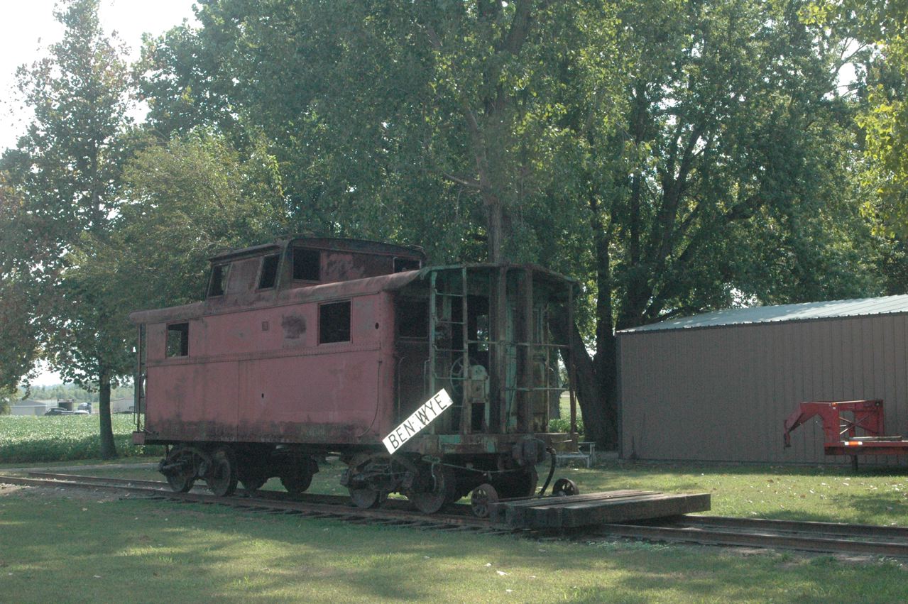
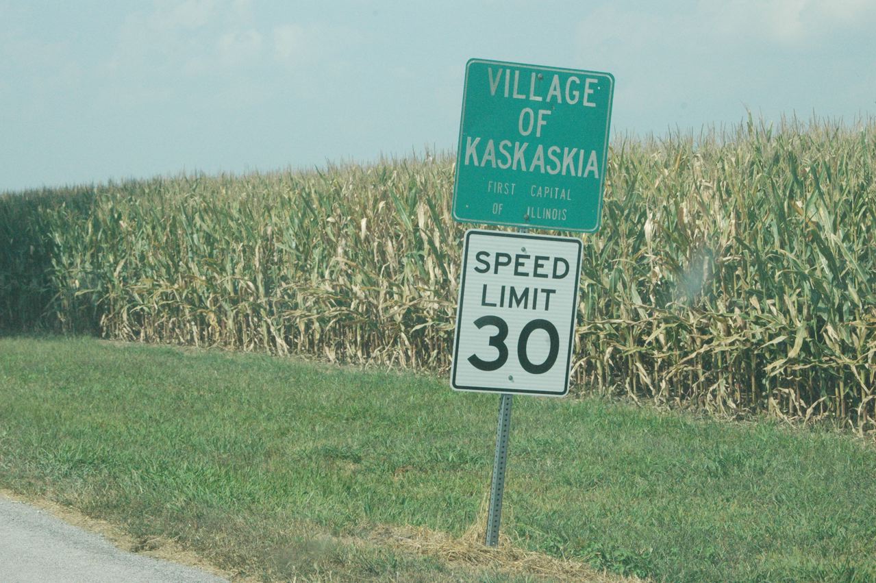
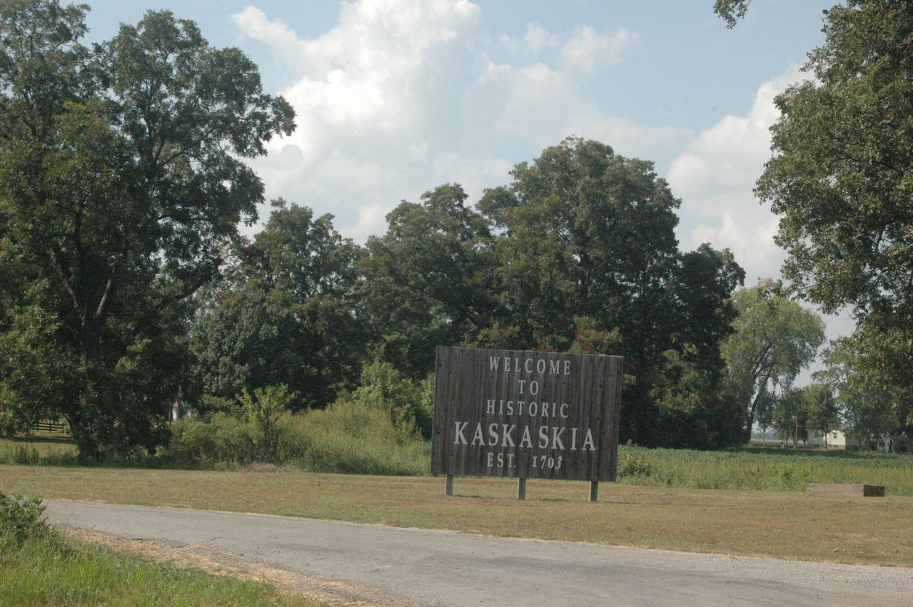
| The main community of Kaskaskia, with population 50 one of the state's smallest incorporated villages, is in the east central portion of the territory (part of Randolph County across the main channel, whose seat is Chester). When you first turn "inland" (east) from the westerly river dike, there is a smaller, unnamed group of dwellings, with of all things, this caboose, either an ex-Pennsylvania cabin car, or possibly a former C&O car, or MP caboose, on makeshift track! This is about the last thing I expected to see on Kaskaskia Island! |
 |
| There's an Old Ben mine in southern Illinois, but no other "Ben" I could i.d. on maps, so who knows what this sign is from. |
 |
| Very little of actual interest in Kaskaskia proper, though it does have an old church and some kind of former school or hotel building. |
 |
 |
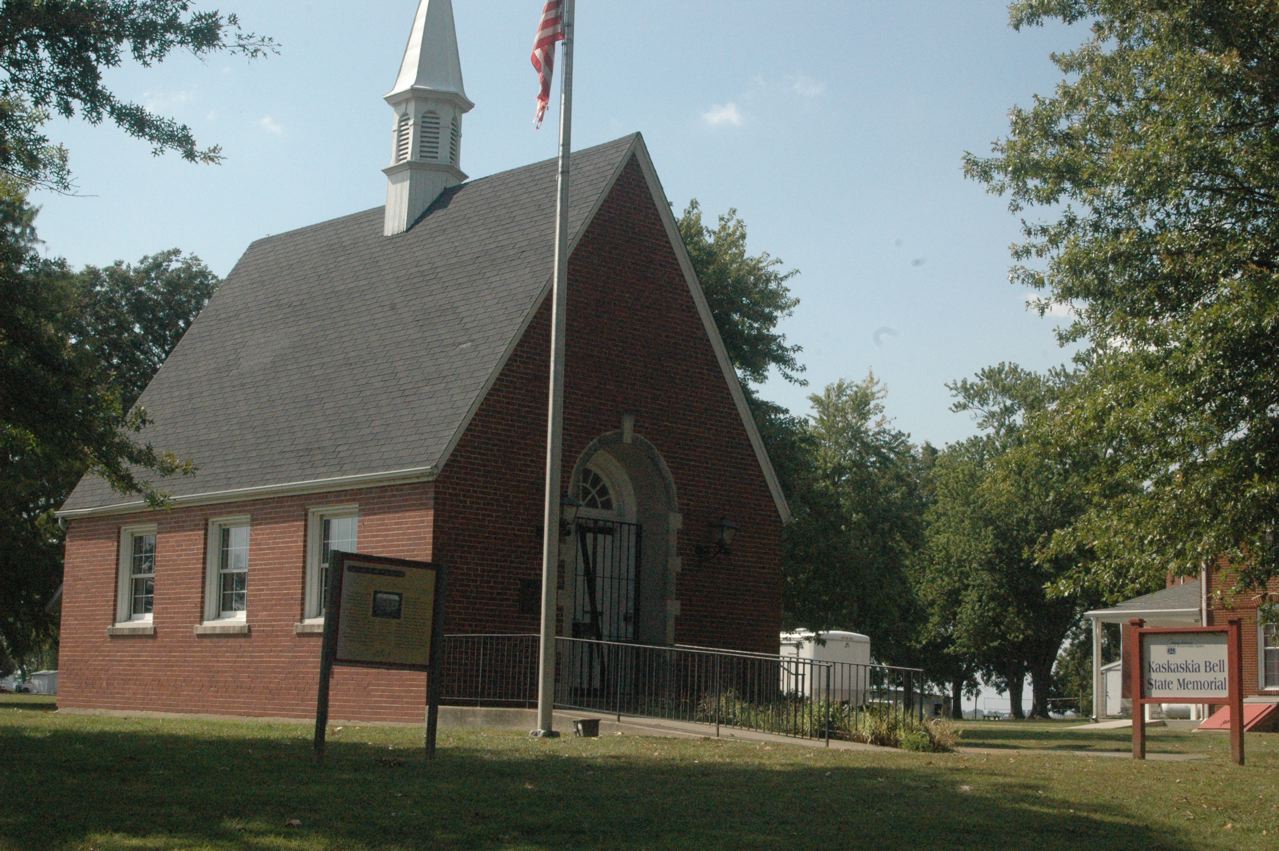
| This new structure was not open, but it must house a bell from perhaps the original capitol? |
 |
 |
| Old building, we think, hotel or school, new windows -- or perhaps a replica of the original capitol? Nothing open, no one around, no clue as to details in this community ... but we can say we have been there! |
 |
| The bridge into Chester, Ill., was featured in a "chase" scene in the 1968 movie "In the Heat of the Night," and there was also a passing MoPac freight in the prelude scene in the chase, beneath the bridge along the river (and tracks) in Chester. |
 |
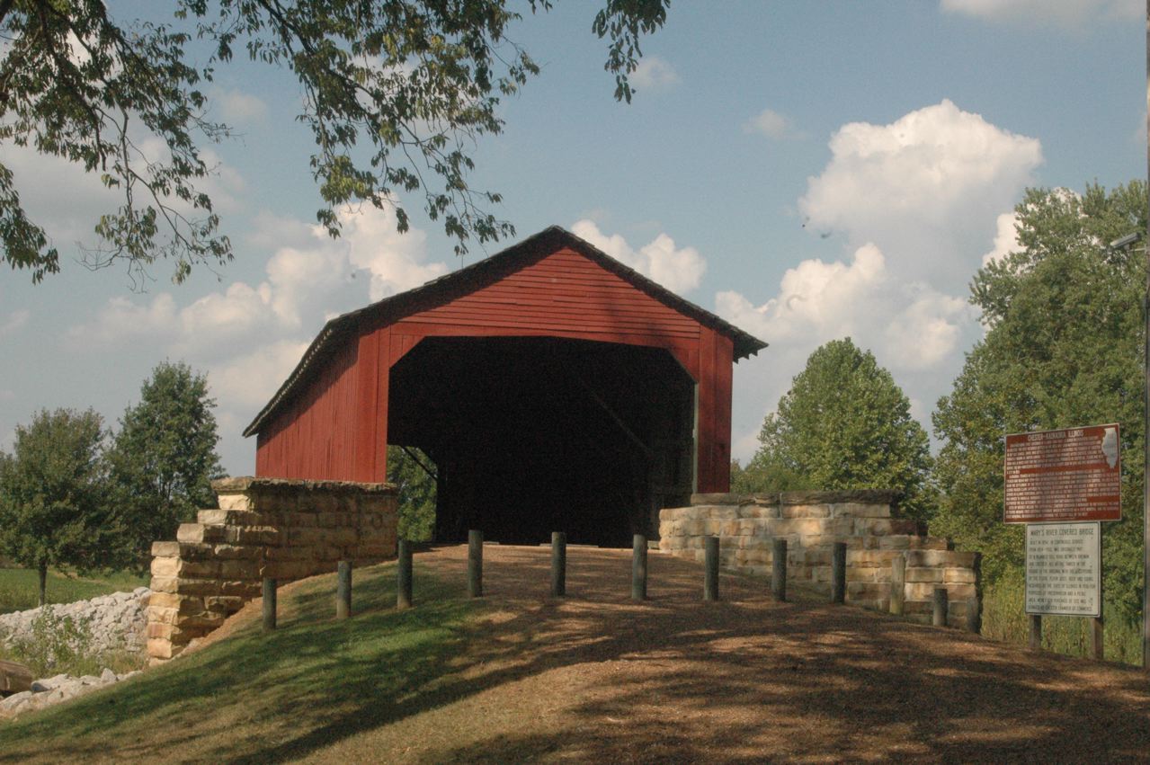
| One of Illinois' half-dozen or so of "original" (old) covered bridges that have been preserved is this one just east of Chester on state Route 150. |
 |
 |
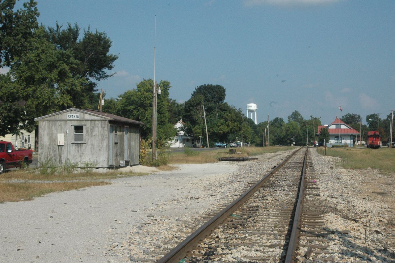
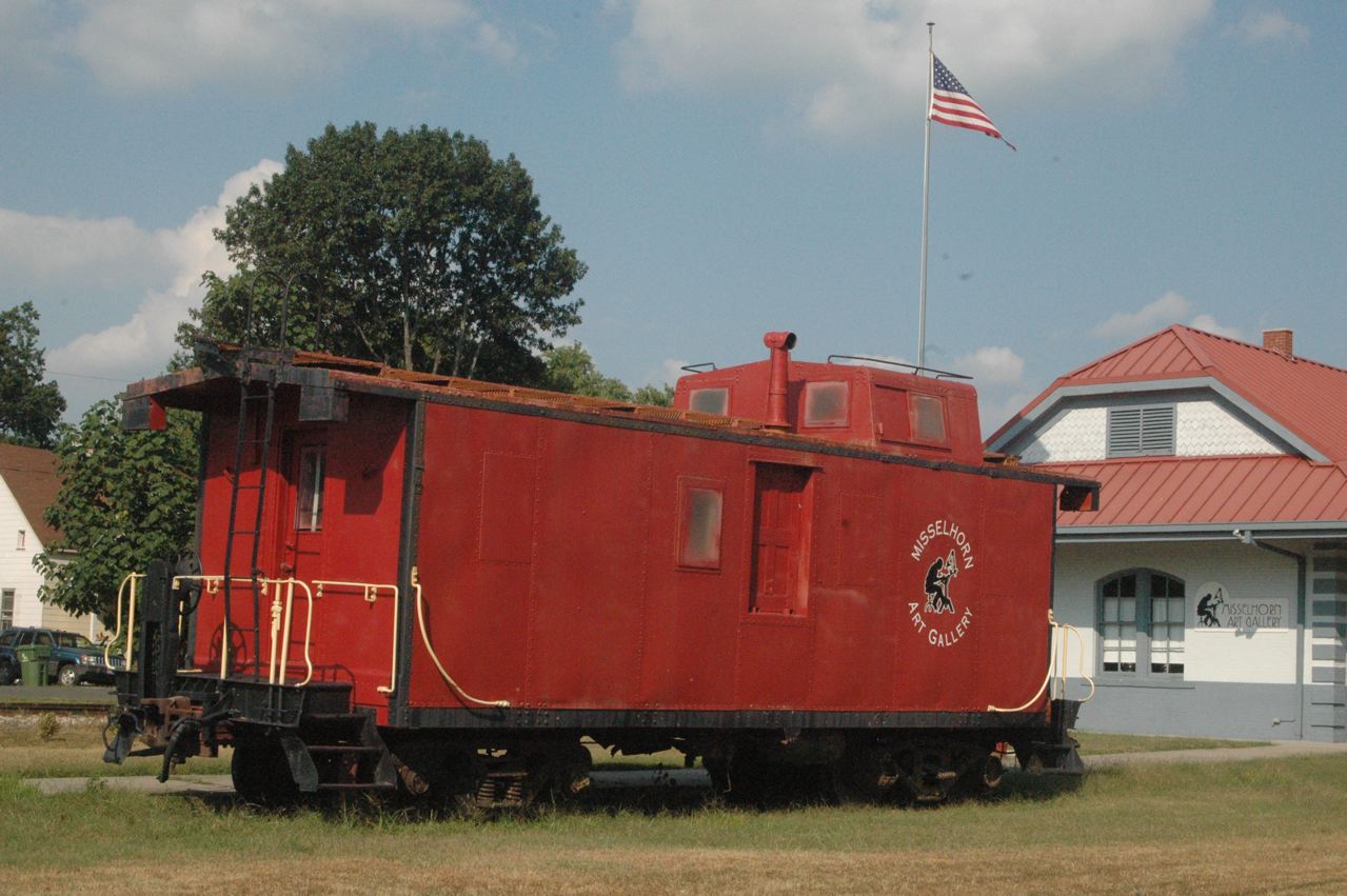
| The old Mobile & Ohio depot (later GM&O) in Sparta, Ill., featured in "In the Heat of the Night" movie, now is an art gallery. It is a few blocks away from downtown, to the west, which probably helped the movie company select it, as there was lots of empty room around it for film crews, et al. This view looks generally south. |
 |
| CN (ex-ICG/GM&O) apparently used this little metal building. This portion of CN's ex-GM&O main line is orphaned from the Illinois Central, but CN coal trains access the line, and its mines, via UP trackage rights (ex-MoPac) thru Percy, Ill. |
 |
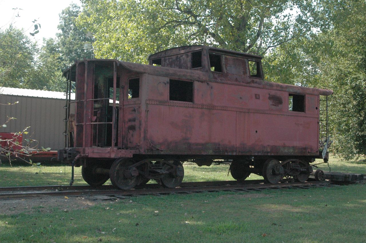
| Close-up of the ex-IC caboose on display at Sparta. |
 |
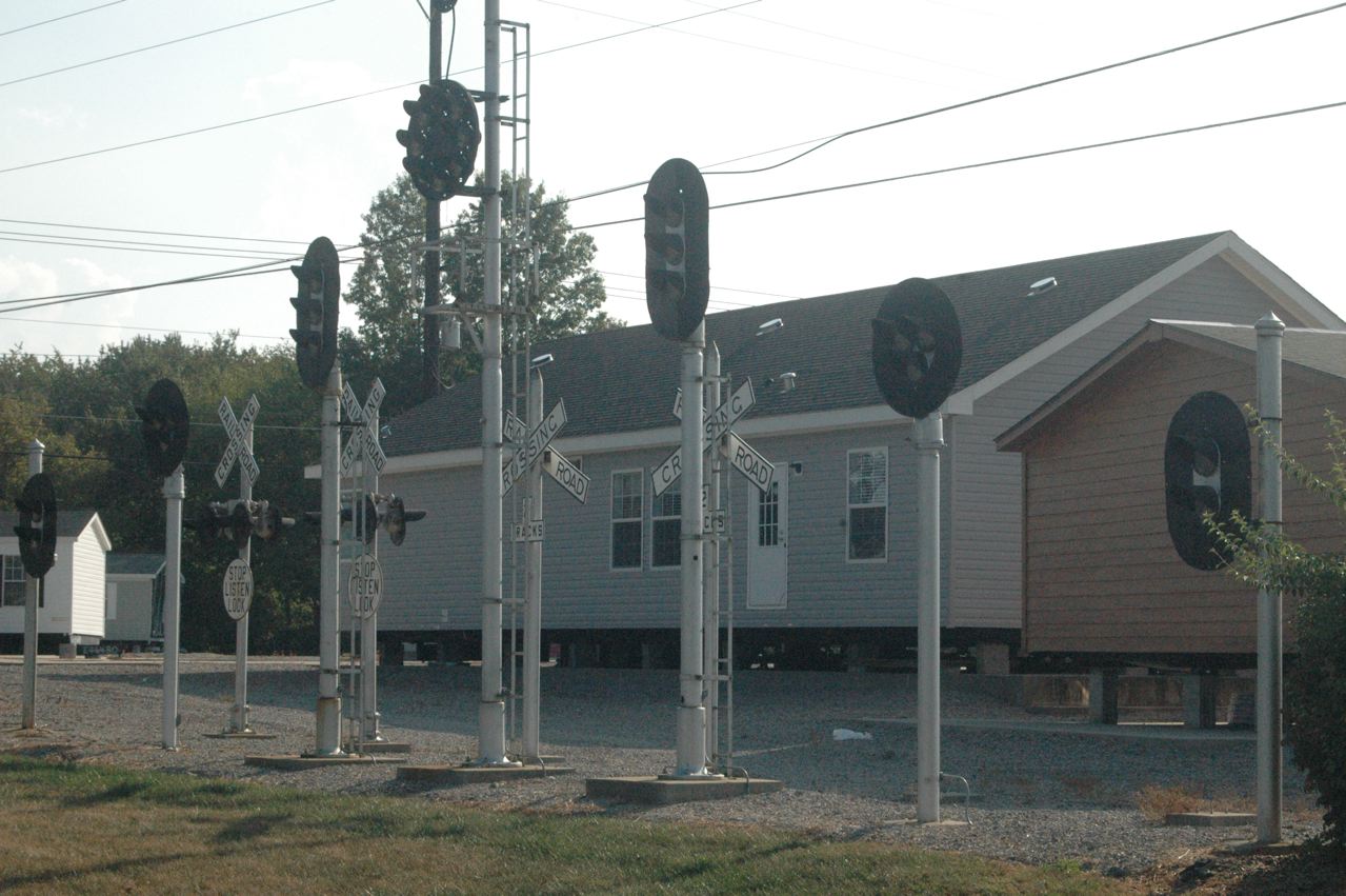
| On the west edge of Pinckneyville, we found in this home dealer's lot this impressive display of railroad signals. Unfortunately I had to shoot this right into the sun, looking southwest. |
 |
| Tennessee's capital city wasn't the only Nashville on the Louisville & Nashville. This was the former Evansville-St. Louis route of L&N, which I rode at night on the Georgian, westbound. The Belleville-E. St. Louis portion now is part of St. Louis Bi-State light-rail system. East of Belleville the line is gone as far as Okawville, but from Okawville to Evansville is operated by the Evansville Western Railway (www.evwr.com), an affiliate of the Paducah & Louisville. |
 |
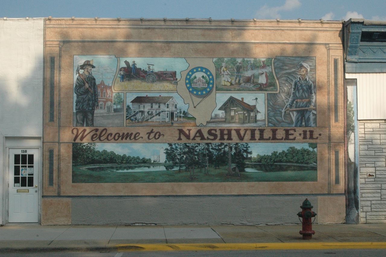 |
| One objective of this trip was to photograph a relatively long and recent Illinois railroad, the Evansville Western, so I had to go to Okawville to see why the line ends there. This facility is why. The next day, I would succeed in photographing, and chasing, an EVWR train, and learned a bit about the railroad (see next file). This was our last photo of Sunday, and we headed east on I-64 to stay overnight in Mt. Vernon, Ill. |
 |
This page was designed and is maintained by Mike Condren. If you have materials
that you would like to contribute, contact me at mcondren@cbu.edu