Missouri Pacific Greenwood Branch
by John Dill
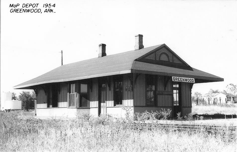
| A 1954 photograph of the northern end of the Missouri Pacific (former Iron Mountain) depot at Greenwood. The depot and yard were located on a hillside which slopes to the east. This location was just north of the present Arkansas Highway Department facility on Highway 10 in Greenwood. The building was constructed in 1888 and moved to a location on Highway 10 (west of Greenwood) for use as a barn after railroad use was discontinued in the mid 1950’s. No evidence of the railroad now exists in the former yard area. The building is believed to have survived until much of Greenwood was leveled by a tornado in 1968. |
 |
| Contributed by John Dill |
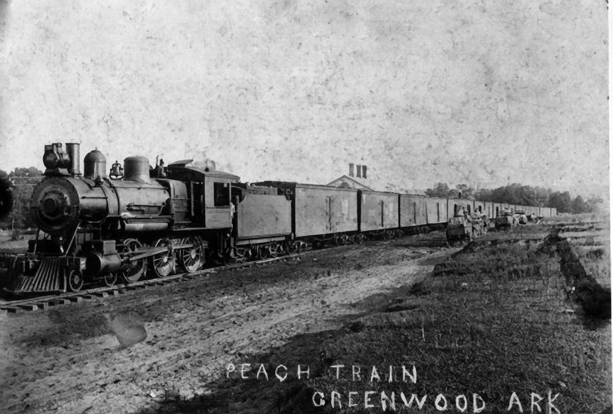
| An Iron Mountain locomotive has been turned (both the Iron Mountain and Midland Valley had wyes on their respective tracks near their junction south of the depot) and is ready to pull an agricultural cargo back toward Fort Smith/Van Buren. The depot can be seen behind the train (the Midland Valley depot was across town, east of the courthouse and town square). This and the following photographs are courtesy of the South Sebastian County Historical Society at Greenwood. |
 |
| Contributed by John Dill |
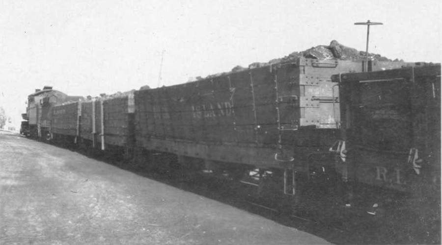
| This photograph shows a string of “foreign” coal cars on the track where the peach train was spotted in the previous photograph. The view is looking north. Sebastian County “smokeless” coal was very popular for passenger locomotive use and in some eras was distributed widely as locomotive fuel. |
 |
| Contributed by John Dill |
| Large Crowds View Exhibits in Greenwood on April 7, 1928
The occasion was a visit by a special train promoting new methods of dairy and poultry farming. On Saturday, April 7th, a large number of farm families from lower Sebastian County attended a meeting that filled the auditorium at the Sebastian County courthouse to hear lectures by experts and specialists accompanying the Missouri Pacific’s train. Among those who spoke were W. H. Lapp, director of the Poultry Research Society of America; W. H. Woodley, the dairy extension specialist of the University of Arkansas; Harry Marsh, field representative of the American Jersey Cattle Club and John Nevitt, dairy development agent for the Missouri Pacific Railroad. The meeting was followed by a parade at the town square with the exhibition of prized animals which were exhibited on the “dairy and poultry special” but brought from the train to take part. The crowd was “more than 3,500 persons. |
 |
| Contributed by John Dill |
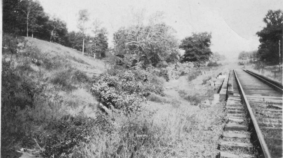
| This locomotive, passing through “Heartsill cut,” has just crossed the girder bridge and is approaching the Greenwood depot. The dirt spoil pile here was later incorporated into the fill for the new highway bridge just to the east. This photo was taken August 7th, 1928. |
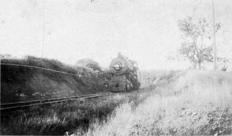 |
| Contributed by John Dill |
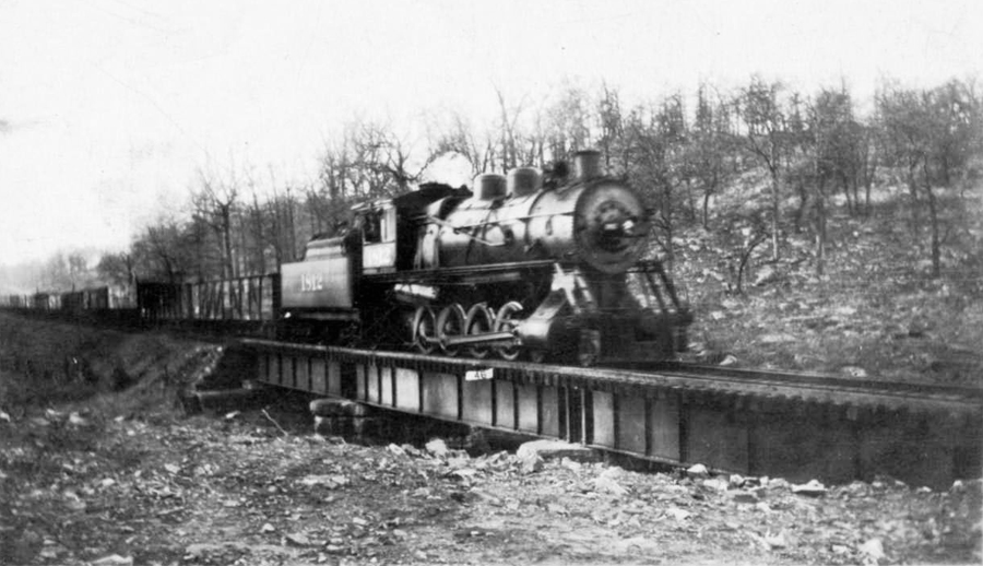
| The “ditcher” has just left “Heartsill cut” and crossed Hackett Road and is approaching the depot (somewhere behind the tree on the left side of the photo). The slope of the hill is evident in the photograph. This photo was taken in September 1942. |
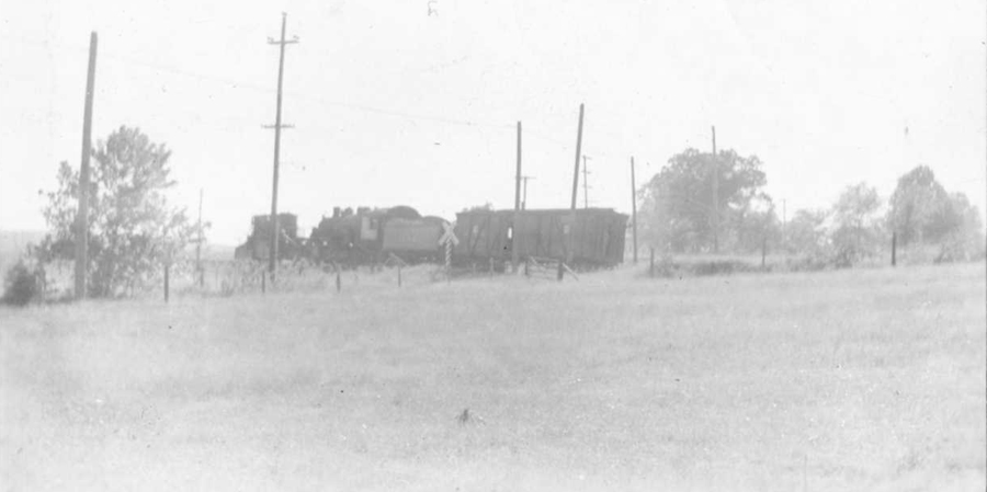 |
| Contributed by John Dill |
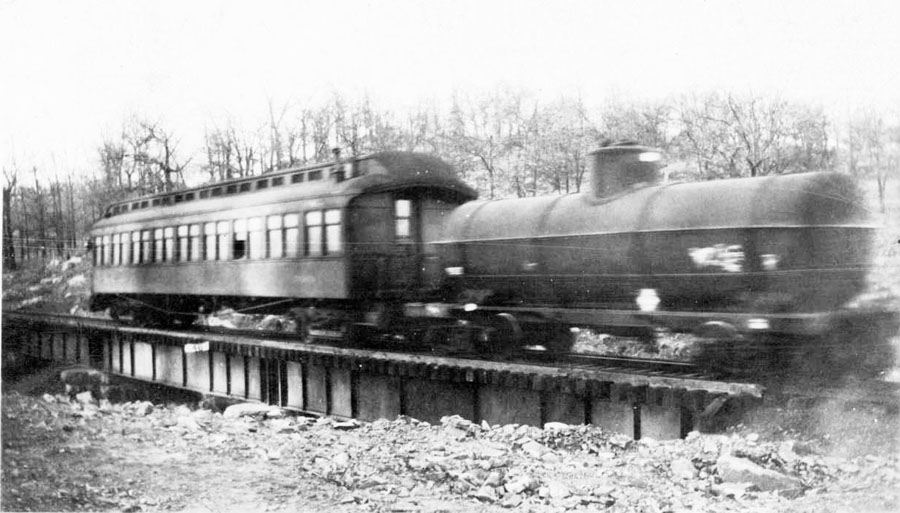
| This train is leaving the yard area, northbound, crossing Old Hackett Road. The date is June 17, 1946. |
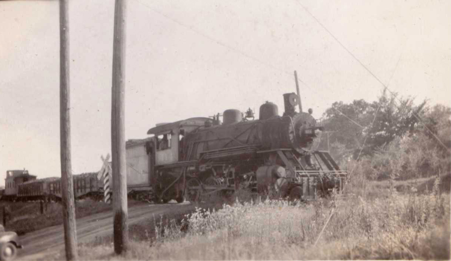 |
| This photo shows the unimproved condition of Old Hackett Road in 1951. A train moving in this direction would have just crossed the steel girder bridge, U.S. Highway 71, and emerged from “Heartsill cut” and is now rapidly approaching the depot. |
 |
| Contributed by John Dill |
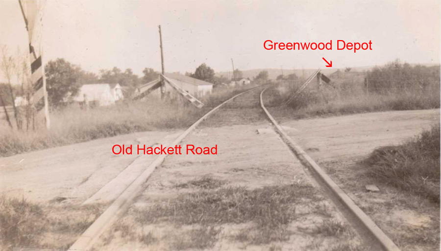
| The Old Hackett Road crossing in 1958. This view is looking north, toward Jenny Lind and Fort Smith. The old rock school building on the hill in the distance (long since converted into a residence) is an identifying feature. |
 |
| Contributed by John Dill |
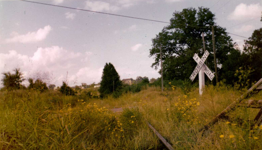
| The steel bridge over Heartsill Creek at Greenwood was a recognizable landmark for many years. It was located just north of U.S. Highway 71 (a little bit west of the location where a BN caboose now resides). This photo was taken in 1927. U.S. Highway 71 (now 10-S) had not yet been carved into the hillside on the left on its way west (then north) to Jenny Lind and Fort Smith. |
 |
| Contributed by John Dill |
| These two undated photographs show both ends of a train which is about to cross U.S. Highway 71 on the final leg of its trip to Greenwood. You can be sure that the coal cars are empties destined for Greenwood. Loaded cars at Jenny Lind were picked up on the return trip through that yard. |
 |
 |
| Contributed by John Dill |
| Instead of the more common “looking north” view, the camera in this photo is pointed south, across the bridge and then the highway. The photo was taken June 17, 1946. |
 |
| Contributed by John Dill |
| The steel bridge is featured one last time, from a vantage near the highway. The photo was taken in 1958 when the south end of the branch was abandoned. |
 |
| Contributed by John Dill |
| “Keller Curve” was the local name for this sweeping curve between Greenwood and Jenny Lind where the track rounded the hill commonly known as “Lovers Leap (Bell Park).” Before entering this curve the track view is north toward Jenny Lind. The photo was taken in 1947. |
 |
| Contributed by John Dill |
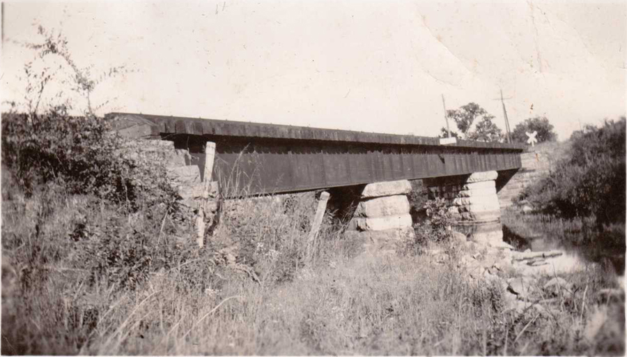
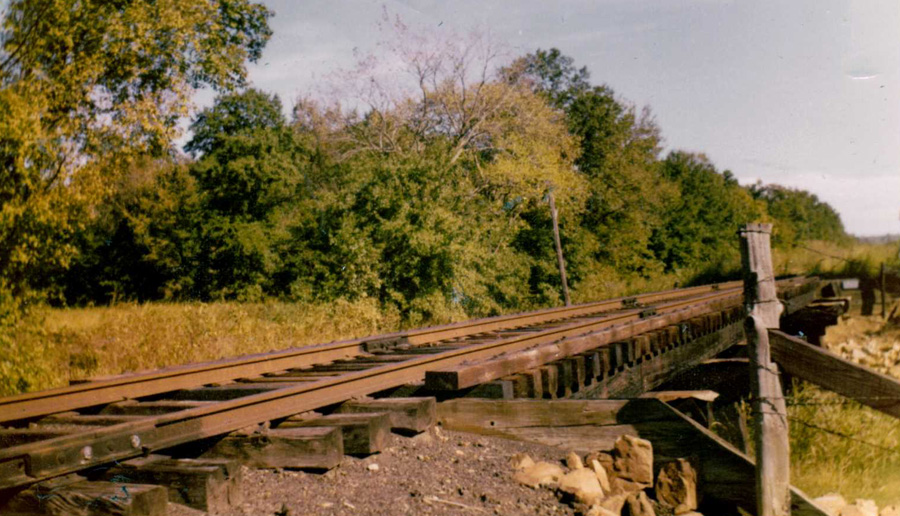
| A few miles after a northbound train left Greenwood, it would encounter the largest trestle on the southern end of the Greenwood Branch. |
%202nd%20MOP%20bridge%20north.jpg) |
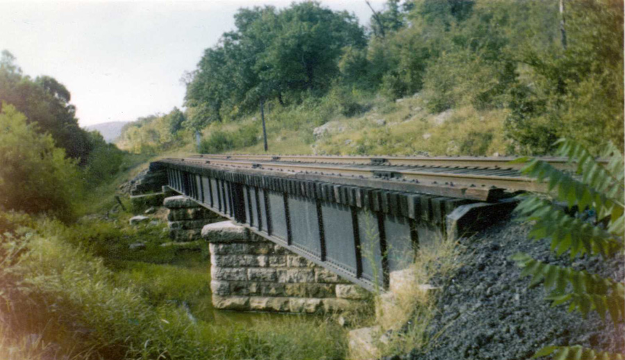
| Contributed by John Dill |
| A color (1958) look at the wooden trestle between Greenwood and Jenny Lind. |
 |
| Contributed by John Dill |
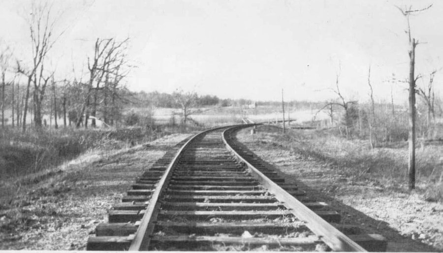
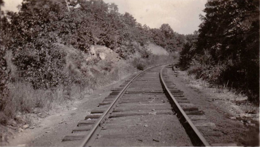
| This June 23, 1946 photograph shows a section of “Gentry cut” just south of Jenny Lind. |
 |
| Contributed by John Dill |
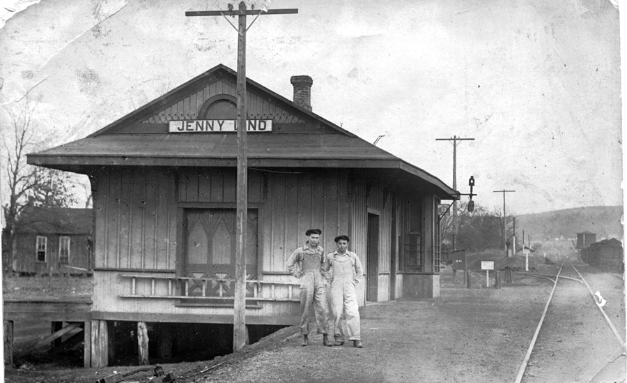
| This 1930’s era photograph shows the Jenny Lind depot. The camera is pointed south toward Greenwood. A switch at the south end of the depot (the front of the building) connected two different coal spurs at different times. At this date the spur terminated several miles east at Mine No. 19. To the right of the main track is the Jenny Lind siding and in the distance, the water tank. The wye to Mine 18 joined the main track just behind the photographer. |
 |
| Contributed by John Dill |
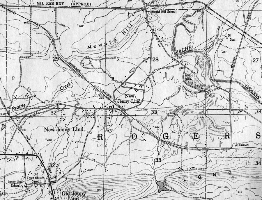
| This USGS map of Jenny Lind was created ca. 1950. Although they are all gone now, and large scale mining has ended, the roadbeds for three former coal spurs can be seen (dashed lines). The track west to Mine 18 began at the wye just north of the Jenny Lind depot and ran west. This track was in use from the late 1890’s until the late 1930’s. Coal mining was almost continuous during that period. The curved spur began just south of the depot and curved around to Mine No. 16. It was in use for a short period during the 1890’s. A second, later, spur track from the same location on the main track, led eastward to Mine No. 19. In the late 1930’s it was rebuilt and used to access R. A Young’s Mine No. 5 which was located to the northeast of New Jenny Lind in what is now Fort Chaffee. |
 |
| Contributed by John Dill |
This site is maintained by the Arkansas Boston Mountains Chapter of the National Railway Historical Society located in Springdale, Arkansas


Home of THE ARKANSAS SCRAMBLER
For questions, email arkyrail at outlook.com